Area Overview for Ash South Ward
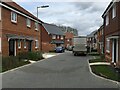
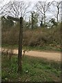
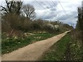
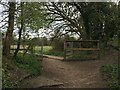
Photos of Ash South Ward
Area Information
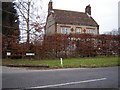
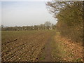
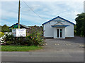
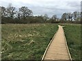
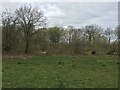
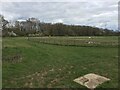
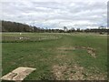
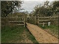
Living in Ash South Ward offers a distinct rural lifestyle within the civil parish of Ash, situated in the far west of Guildford borough. This small district covers just 2.5 square kilometres, placing it firmly in the South East English Region. The ward borders both Hampshire and Berkshire, providing direct road connections to Aldershot, Farnham, and Guildford. You will find the area positioned on the eastern side of the River Blackwater, a geographical feature that defines its character. Residents here experience a friendly, down-to-earth village atmosphere where countryside meets convenience. The pace of life remains relaxed, blending green spaces and quiet lanes with local amenities. This quiet setting supports those seeking a grounded community spirit without complete isolation. You gain access to open commons, woodland, and riverside paths, with the Basingstoke Canal and Ash Ranges offering scenic walks. The village maintains local shops, pubs, and a library, ensuring daily needs are met within the parish. By choosing Ash South Ward, you select a home located close to major transport links while retaining the privacy of Surrey's heritage mix. The area operates as a largely rural constituency, balancing the charm of nature reserves with the practicality of being near major cities like London and Gatwick.
- Area Type
- District Borough Unitary Ward
- Area Size
- 2.5 km²
- Population
- Not available
- Population Density
- Not available
Demographics
The community in Ash South Ward is defined by an older demographic profile. The median age for residents is 70, indicating a population skewed significantly towards older adults. This age distribution suggests a neighbourhood built for retirement or long-term residency rather than a hub for young families or students. You are entering a community where the total household composition reflects this demographic reality. Eighty-three per cent of homes in the ward are owner-occupied, demonstrating a high level of stability and rootness within the area. This figure is notably high and signals that most residents have purchased their property over time rather than renting. The accommodation types and ethnicity data are recorded for the total population, providing a baseline for the ward's make-up. While specific breakdowns for younger age ranges are not detailed in the current records, the prevailing age group of 70 paints a clear picture of who lives here. When considering deprivation levels in this context, the high ownership rate usually correlates with established, settled communities where long-term residents have invested in their local environment. The absence of a young workforce demographic might limit evening social scenes but fosters a peaceful, quiet atmosphere. If you are looking for a family-centric area with schools nearby, you must weigh these demographics carefully against your specific lifestyle needs. The data confirms a stable, older populace with a strong commitment to property ownership.
Household Size
Accommodation Type
Tenure
Ethnic Group
Religion
Household Composition
Age
Household Deprivation
NS-SEC
Explore more demographic insights in this area
Go to Demographics tabPlanning
Planning Constraints
- Flood RiskPremium
- Ramsar Wetland SitesPremium
- Area of Outstanding Natural BeautyPremium
- Protected Nature ReservePremium
- Protected WoodlandPremium
- Crime RiskPremium