Area Overview for Arncott
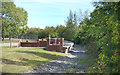
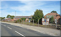
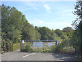
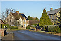
Photos of Arncott


Area Information
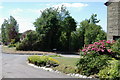
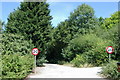
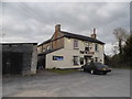
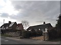
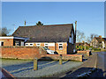
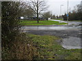
Living in Arncott means embracing the quiet rhythm of a small rural parish in England. This civil parish covers 6.9 km², offering residents a tangible sense of space and separation from the dense urban sprawl found closer to major towns. You can expect a community where daily life moves at a slower pace, defined by green surroundings and established local traditions rather than high-energy commercial hubs. The area distinguishes itself through its homogeneous character and deep-rooted history, which tends to attract those seeking stability over rapid development. When you walk through the neighbourhood, you are entering a space where the built environment has remained largely unchanged for generations. This consistency provides a secure backdrop for everyday activities, from shopping at local providers to enjoying walks in the open countryside. The absence of significant planning constraints such as protected wetlands or Areas of Outstanding Natural Beauty allows for a straightforward landscape, yet the presence of specific protected woodlands ensures that nature retains a special legal status within the parish boundaries. Prospective buyers often appreciate that Arncott offers a genuine rural experience without the isolation of completely uninhabited countryside. It is a place where the focus remains on the immediate environment and the people who call this land home, providing a stable foundation for family life.
- Area Type
- Parish
- Area Size
- 6.9 km²
- Population
- Not available
- Population Density
- Not available
Demographics
The community in Arncott reflects a well-established settlement dominated by older residents. The median age here stands at 70, indicating that the population is significantly older than the national average. You will find that the most common age range encompasses the total population, suggesting a demographic that skews heavily towards retirement years rather than working-age families. This profile naturally influences the social fabric, creating a neighbourly environment focused on quiet enjoyment and established routines. Home ownership is the defining feature of local life, with 72% of households owning their property outright or with a mortgage. This high rate of ownership typically correlates with residents who have lived in the area for decades and are invested in its long-term stability. While data on specific ethnic groups and religious affiliations are not detailed in current records, the uniform age profile suggests a culturally consistent community. The lack of young families or transient populations points to a settled lifestyle where residents have made Arncott their permanent base. For someone considering a move, knowing that the majority of neighbours own their homes can signal a low-turnover community where relationships develop gradually over many years. This demographic reality also means that local amenities and services are likely tailored to the needs of an older population.
Household Size
Accommodation Type
Tenure
Ethnic Group
Religion
Household Composition
Age
Household Deprivation
NS-SEC
Explore more demographic insights in this area
Go to Demographics tabPlanning
Planning Constraints
- Flood RiskPremium
- Ramsar Wetland SitesPremium
- Area of Outstanding Natural BeautyPremium
- Protected Nature ReservePremium
- Protected WoodlandPremium
- Crime RiskPremium