Area Overview for Appleton-with-Eaton
Photos of Appleton-with-Eaton
Area Information
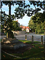
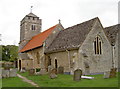
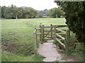
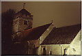
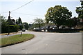
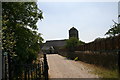
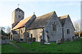
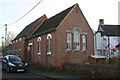
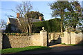
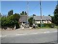
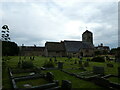
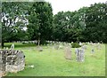
Appleton-with-Eaton is a civil parish situated in the Vale of White Horse district of Oxfordshire. The area spans 8.9 km² and combines the village of Appleton with the hamlet of Eaton. You are located approximately 4 miles northwest of Abingdon and southwest of Oxford. The parish population stood at 915 during the 2011 Census. This reflects a secluded existence within the countryside. The village centres on historic landmarks such as the Grade II* listed Church of England parish church of Saint Laurence. This building features 12th-century Norman elements and a 15th-century Perpendicular Gothic bell tower. The Parish Council manages local assets including the sportsfield and the Village Hall. Residents also access land that includes the war memorial site. Your daily life revolves around these community assets and the surrounding rural landscape. You will find a setting that has evolved from its ancient roots, originally mentioned as Aeppeltune in a 942 charter. The area has undergone significant historical shifts, moving from Berkshire to Oxfordshire following 1974 boundary changes. Now, living in Appleton-with-Eaton means enjoying a quiet environment defined by its deep history and close proximity to larger towns like Oxford. The postcode area serves as a peaceful retreat for those seeking a slower pace of life away from city noise.
- Area Type
- Parish
- Area Size
- 8.9 km²
- Population
- Not available
- Population Density
- Not available
Demographics
The community in Appleton-with-Eaton consists of 77% owner-occupied homes. This high rate indicates that the local residents tend to stay within the parish for extended periods. The demographic profile shows a median age of 70 years. This figure suggests the neighbourhood is predominantly settled by older residents. You will find that the area caters to an established demographic rather than young families or transient populations. The household composition data describes the total configuration of homes within the parish. There are no specific breakouts for single-person households or family units in the current data. You can assume the housing stock supports the age profile observed. The area contains a mix of rural living arrangements. Living in Appleton-with-Eaton involves joining a community with a distinct identity shaped by long-term residency. You will not find a young professional demographic draining the village character. The 2011 Census recorded the total population at 915 individuals. This number provides a small, manageable community size. You are entering a parish where the majority of dwellings are owned outright. The demographics reflect stability and a lack of rapid population turnover.
Household Size
Accommodation Type
Tenure
Ethnic Group
Religion
Household Composition
Age
Household Deprivation
NS-SEC
Explore more demographic insights in this area
Go to Demographics tabPlanning
Planning Constraints
- Flood RiskPremium
- Ramsar Wetland SitesPremium
- Area of Outstanding Natural BeautyPremium
- Protected Nature ReservePremium
- Protected WoodlandPremium
- Crime RiskPremium