Area Overview for Angmering
Photos of Angmering
Area Information
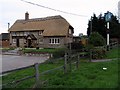
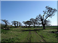
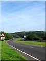
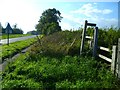
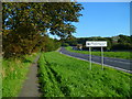
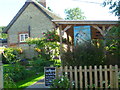
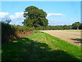
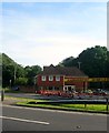
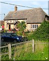
Angmering sits as a civil parish in the Arun District of West Sussex, extending across 17.8 km². The population stands at 1,566 people, creating a quiet residential setting that balances village charm with modern growth. Living in Angmering means experiencing a historic landscape defined by ancient Bronze Age settlements and the remains of a large Roman villa near Highdown Hill. The area originally comprised three separate parishes, including East Angmering and West Angmering, which combined by the 16th century. Today, the village core centres on historic houses dating back to the 15th century, mixed with recent housing developments that have increased the population rapidly. You will find farms, small shops, and a post office alongside these older structures. The South Coast railway line passes nearby, offering Angmering station as a key transport link approximately four miles east of Arundel. This mix of deep history, such as the site part-excavated in the 1930s, and contemporary expansion makes it a distinct choice for those seeking homes in Angmering. While the settlement has expanded, it retains its identity as a semi-rural community benefiting from tributaries of the River Arun that shaped its early development.
- Area Type
- Parish
- Area Size
- 17.8 km²
- Population
- 1566
- Population Density
- 88 people/km²
Demographics
The community in Angmering reflects a settled lifestyle with a median age of 70 years. This demographic profile suggests a neighbourhood where many residents are retired or in later life stages. High home ownership is a defining characteristic of the area, with 81% of households owning their property outright. This figure indicates a long-term community rather than a transient rental market. The household composition data does not specify the exact breakdown of family sizes, but the high ownership rate aligns with an age profile that values stability. You will find a predominantly established population living within the parish boundaries. The area does not provide specific data on predominant ethnic groups or religious affiliation in the available records. Deprivation data is not included in the provided statistics, so you cannot assess income inequality directly. However, the combination of an older population and high ownership rates paints a picture of a stable, wealthier cohort. When considering schools near Angmering, the presence of three local institutions supports this family-friendly yet mature environment.
Household Size
Accommodation Type
Tenure
Ethnic Group
Religion
Household Composition
Age
Household Deprivation
NS-SEC
Explore more demographic insights in this area
Go to Demographics tabPlanning
Planning Constraints
- Flood RiskPremium
- Ramsar Wetland SitesPremium
- Area of Outstanding Natural BeautyPremium
- Protected Nature ReservePremium
- Protected WoodlandPremium