Area Overview for Ampfield
Photos of Ampfield

Area Information
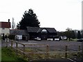
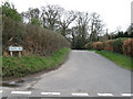
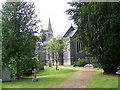
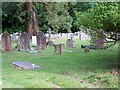
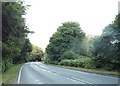
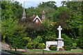
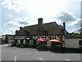
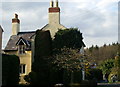
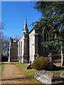
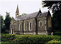
Ampfield is a civil parish situated in the Borough of Test Valley, Hampshire, covering an area of 9.7 km². The village retains a strong rural character with large tracts of Ampfield Wood and field boundaries that remain unchanged since 1588. A countryside area designated as a Heritage Area lies within these limits. The local population stands at 1,762 people, creating a density of 1.81 people per hectare, which is below the borough average. Most residents live within close proximity to Romsey, which lies 4 miles to the east north-east, as well as Eastleigh and Winchester. The village became a separate civil parish in 1894, originating from the ecclesiastical parish of Hursley. Key local institutions include St Mark's Church, the Ampfield Church of England Primary School, and the Village Hall. The community features several amenities such as The White Horse Pub, The Potters Heron Hotel, and Keats Restaurant. Residents also enjoy access to the Recreation Ground and Ampfield Golf Club. Historical significance runs deep in the location, with a Village Design Statement adopted in 2019 to preserve its distinctive natural and man-made features alongside sites like Chapel Wood.
- Area Type
- Parish
- Area Size
- 9.7 km²
- Population
- Not available
- Population Density
- Not available
Demographics
The community in Ampfield shows a clear demographic profile that reflects a settled population. The median age for residents is 70 years, indicating a significant presence of older adults compared to younger cohorts. Household composition data confirms this trend without detailing specific breakdowns by family type. The area maintains a high rate of home ownership, with 85% of households owning their homes outright or with a mortgage. Conversely, this high ownership rate implies that rental options are limited for those seeking to rent rather than buy. The ethnic background of the village is predominantly White British, with 93.9% of residents identifying as such. The predominant religion among the population is Christianity, which accounts for 65% of residents. This makes Ampfield a largely uniform community where the majority share similar cultural and religious backgrounds. The area does not have available data regarding specific deprivation levels, but the high level of home ownership and stable population suggest a settled environment. Local life revolves around the parish council history dating back to 1848, with residents often participating in community events at the Village Hall or attending services at St Mark's Church.
Household Size
Accommodation Type
Tenure
Ethnic Group
Religion
Household Composition
Age
Household Deprivation
NS-SEC
Explore more demographic insights in this area
Go to Demographics tabPlanning
Planning Constraints
- Flood RiskPremium
- Ramsar Wetland SitesPremium
- Area of Outstanding Natural BeautyPremium
- Protected Nature ReservePremium
- Protected WoodlandPremium
- Crime RiskPremium