Area Overview for Alverstoke Ward
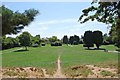
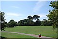
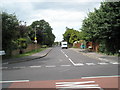
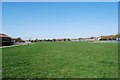
Photos of Alverstoke Ward
Area Information
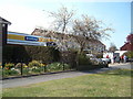
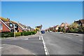
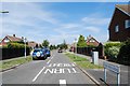
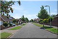
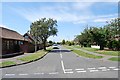
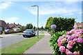
Alverstoke Ward is a district borough unitary ward situated on the south coast of England within the Borough of Gosport. This residential area covers just 2.1 km² and stretches east-west from Fort Blockhouse to Browndown Battery. You will find it centred 0.5 miles east of Stokes Bay on the Solent, near the head of a creek from Portsmouth Harbour. The location places it at the southern end of the Gosport Peninsula, with coordinates approximately 50.78°N 1.15°W. First mentioned in the Domesday Book of 1086, the ward carries significant historical weight, having been known as 'Alwarestoch' before earlier existence under the name 'Stoke' for about 200 years. Monks of St Swithun's in Winchester once owned this land, which was legendarily given by Saxon Lady Alvara. The parish originally covered much of present-day Gosport until subdivisions occurred between 1840 and 1913. During the early 19th century, Angleseyville developed as a seaside resort area. Today, you live in a mainly residential area surrounded by twentieth-century development. The community includes many Royal Navy personnel and retirees. Living in Alverstoke Ward means being part of a continuous urban setting of Gosport, where your local electoral ward contributes around 18,000 people to the borough total of 85,000.
- Area Type
- District Borough Unitary Ward
- Area Size
- 2.1 km²
- Population
- Not available
- Population Density
- Not available
Demographics
The community in Alverstoke Ward reflects a settled and stable population. The median age in this area is 70, which establishes a distinctly older demographic profile compared to many national averages. This age distribution often influences local services and social activities. Households in Alverstoke Ward show a high rate of stability, with 85% of residents owning their homes. This figure indicates that the area is not a transient zone but a place where people put down roots for the long term. The remaining 15% of households operate under different tenancy arrangements, though specific breakdowns for rented properties versus social housing are not detailed. There are no recorded constraints regarding Ramsar wetland sites, areas of outstanding natural beauty, protected nature reserves, or protected woodland within the ward's boundaries. These planning constraints receive a pass level assessment, scoring 0 on the risk scale where lower values indicate less restriction. In terms of diversity, data detailing the predominant ethnic group and religious affiliation is not explicitly quantified in the available records. However, the established nature of the ward, combined with its proximity to a major naval base, implies a community built on long-term residency. When considering homes in Alverstoke Ward, expect a neighbourhood defined by age and home ownership rather than rapid demographic shifts.
Household Size
Accommodation Type
Tenure
Ethnic Group
Religion
Household Composition
Age
Household Deprivation
NS-SEC
Explore more demographic insights in this area
Go to Demographics tabPlanning
Planning Constraints
- Flood RiskPremium
- Ramsar Wetland SitesPremium
- Area of Outstanding Natural BeautyPremium
- Protected Nature ReservePremium
- Protected WoodlandPremium