Area Overview for Alton Whitedown Ward
Photos of Alton Whitedown Ward


Area Information
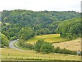
Alton Whitedown Ward occupies a compact footprint of just one square kilometre within the East Hampshire district in southern England. This small electoral ward forms an integral part of the larger town of Alton, situated at approximately 51.1425°N, 0.9898°W. Recent census data indicates a population of around 2,407 residents, creating a densely populated urban environment despite its tiny geographical size. Living in Alton Whitedown Ward means you are embedded in the historic market town of Alton, centred near coordinates that place you in the geographical heart of the settlement. The ward is essentially a sub-area of a busy town rather than a distinct rural village or sprawling suburb. This central location implies proximity to the town's main commercial and educational hubs, meaning your daily commute to shops or services is measured in minutes rather than miles. You will find yourself surrounded by long-standing Alton competition for property due to this concentration of residents in such limited space. The area represents a classic urban ward where the built environment dominates the landscape, offering convenience over countryside views.
- Area Type
- District Borough Unitary Ward
- Area Size
- 1.0 km²
- Population
- Not available
- Population Density
- Not available
Demographics
The community structure of Alton Whitedown Ward reveals a significant demographic skew towards older residents. You will find that the median age within the ward stands at 70 years, indicating a population composed largely of retirees or senior citizens. While the provided data lists 'Age: Total' as the most common age range without a specific figure, the high median age confirms an elderly demographic focus. Home ownership is the primary mode of accommodation, with 64% of households owning their homes outright or with a mortgage. This high rate suggests a settled population where long-term residents have established roots in the ward over many years. The available statistics do not specify detailed household composition types, such as the percentage of single-person homes versus families, nor do they break down room occupancy figures. Consequently, you must view the accommodation data as reflecting a broad total of housing types present in this single ward. The ethnographic and religious profiles of the area are listed simply as 'total', meaning specific data on diversity or faith breakdown is not individually detailed in the records. Living here involves interacting with a mature community where property values likely align with the preferences of older homeowners rather than young families with school-age children.
Household Size
Accommodation Type
Tenure
Ethnic Group
Religion
Household Composition
Age
Household Deprivation
NS-SEC
Explore more demographic insights in this area
Go to Demographics tabPlanning
Planning Constraints
- Flood RiskPremium
- Ramsar Wetland SitesPremium
- Area of Outstanding Natural BeautyPremium
- Protected Nature ReservePremium
- Protected WoodlandPremium
- Crime RiskPremium