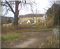
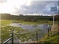
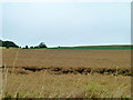
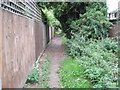
Area Overview for Alton Amery Ward
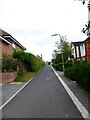
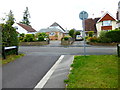
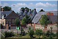
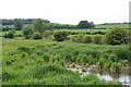
Photos of Alton Amery Ward
Area Information
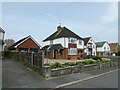
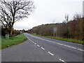
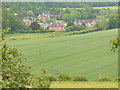
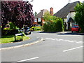
Living in Alton Amery Ward offers a specific lifestyle within the East Hampshire District Council area. This electoral ward sits approximately at coordinates 51.154257, -0.991078, forming one part of the larger Alton group of wards. It neighbours Alton Ashdell, Eastbrooke, Holybourne, Westbrooke, Whitedown and Wooteys. The total land coverage is just 2.1 km², indicating a compact residential environment closely tied to the central town of Alton. You are essentially purchasing a property within the administrative bounds of the unitary ward system established for local governance. Daily life here revolves around the geographical constraints of this small district. The area functions as a distinct community unit rather than a sprawling suburban district. Its classification as a borough unitary ward means you benefit from a specific layer of local council administration focused on these boundaries. The location places you directly within the Alton municipality, offering immediate access to the services typically associated with a market town setting. The compact nature of the 2.1 km² footprint suggests that distances to local amenities are minimal. You can expect a setting defined by its administrative history and precise geographic coordinates rather than vast expanse. The ward serves as a fundamental planning and electoral unit for residents of this Hampshire location. Understanding the ward boundaries is essential for any serious consideration of properties in Alton Amery Ward. This specific electoral division determines how your local services are delivered and how you engage with local governance.
- Area Type
- District Borough Unitary Ward
- Area Size
- 2.1 km²
- Population
- Not available
- Population Density
- Not available
Demographics
The community in Alton Amery Ward presents an older demographic profile. The median age for residents reaches 70 years, placing it firmly in a senior-dominated cohort. While the most common age range aggregates to Total, the high median indicates a shift away from typical young family demographics. You are looking at a neighbourhood where a significant portion of the population is further along in life. This age structure shapes the local demand for specific facilities and services. Home ownership stands at a high level of 83%. This figure signifies that the vast majority of houses in Alton Amery Ward are occupied by their owners rather than tenants. The remaining 17% consists of private or social rental homes, which form the smaller segment of the market. The predominant ethnic group data aggregates to Total, reflecting the statistical reality of aggregated ward data without specific breakdowns. Similarly, household composition is recorded as a total aggregate. High home ownership rates usually correlate with long-term settlement. Residents in Alton Amery Ward have likely lived in their properties for many years. This stability often creates tight-knit communities, though it may affect the availability of starter homes for younger buyers. The accommodation type data aggregates to Total, meaning detailed splits between detached, semi-detached, or terraced properties are not itemised in the available figures. Nevertheless, the 83% ownership rate suggests a market driven by existing stock rather than frequent turnover.
Household Size
Accommodation Type
Tenure
Ethnic Group
Religion
Household Composition
Age
Household Deprivation
NS-SEC
Explore more demographic insights in this area
Go to Demographics tabPlanning
Planning Constraints
- Flood RiskLocked
- Ramsar Wetland SitesLocked
- Area of Outstanding Natural BeautyLocked
- Protected Nature ReserveLocked
- Protected WoodlandLocked
- Crime RiskLocked