Area Overview for Allington & Bridge Ward
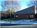
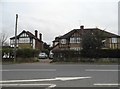
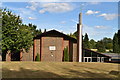
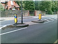
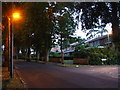
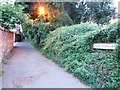
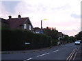
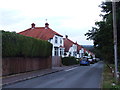
Photos of Allington & Bridge Ward


Area Information
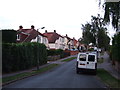
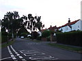
Living in Allington & Bridge Ward offers a specific slice of life within the expansive Maidstone Borough Council area in Kent. This district council ward occupies a relatively compact footprint of just 2.6 km², creating a neighbourhood where local networks often operate on tighter loops than in larger urban zones. Situated at coordinates approximately 51.29°N, 0.51°E, the ward sits firmly within the South East region of England. The geography reflects a settled residential pattern typical of a developed ward in the modern district of Maidstone. Prospective buyers looking at Allington & Bridge Ward should expect a community defined by its established boundaries rather than rapid expansion. The area functions as a recognised part of the local electoral and administrative landscape, featuring distinct voting districts and boundary maps that have been defined by local democracy groups. For anyone considering homes in this location, the physical scale means you will likely know your immediate surroundings well. Daily life here is shaped by the specific limits of the ward while remaining connected to the broader framework of the Maidstone district. You are looking at a place where the ward structure directly influences local governance and community identity.
- Area Type
- District Borough Unitary Ward
- Area Size
- 2.6 km²
- Population
- Not available
- Population Density
- Not available
Demographics
The community profile in Allington & Bridge Ward reveals a distinct demographic settlement. The resident population has a median age of 70 years, indicating a settlement that attracts or retains an older demographic compared to national averages. This age profile suggests households here are often built around retirement or later-life living arrangements rather than young family expansion. Home ownership stands at 62%, a figure that places the area in a strong owner-occupied market compared to regional rental hotspots. This high level of ownership implies stability within the local neighbourhood structure. When evaluating schools near Allington & Bridge Ward, you must consider the age of current residents, as the population skew likely influences school intake patterns significantly. The household composition data indicates a total mix, yet the median age strongly suggests a decline in small households with young children. The predominant ethnic group and religious affiliations remain documented in the total count without further specific breakdown available in this dataset. Understanding these figures means you know the area is not rapidly gentrifying with young professionals but remains a stable environment. You are looking at a community where residents have likely lived through multiple life stages.
Household Size
Accommodation Type
Tenure
Ethnic Group
Religion
Household Composition
Age
Household Deprivation
NS-SEC
Explore more demographic insights in this area
Go to Demographics tabPlanning
Planning Constraints
- Flood RiskPremium
- Ramsar Wetland SitesPremium
- Area of Outstanding Natural BeautyPremium
- Protected Nature ReservePremium
- Protected WoodlandPremium
- Crime RiskPremium