Area Overview for Alfold Crossways
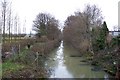
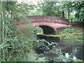
Photos of Alfold Crossways
Area Information
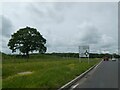
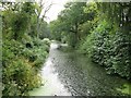
Alfold Crossways is a built-up area covering 1.4 square kilometres in Surrey. It exists as a distinct residential pocket rather than a standalone town. The locale functions as a satellite community within the wider Alford region. Residents here enjoy a quiet existence defined by proximity to established villages like Cranleigh and Witley. Daily life revolves around accessing nearby transport hubs and shopping centres without needing extensive travel. You will find homes in Alfold Crossways situated close to essential services such as Sainsburys Cranleigh and Milford Railway Station. The area lacks the density of a major city centre but provides sufficient infrastructure for independent living. Noise levels remain moderate compared to bustling urban centres. Commuters rely heavily on the rail network connecting to Witley and Milford stations. You can expect a pace of life that balances countryside tranquility with practical access to amenities. The specific layout means short walks often replace car journeys for local needs. Families and retirees both find the scale of this 1.4 km² zone manageable for daily routines.
- Area Type
- Built Up Area 250
- Area Size
- 1.4 km²
- Population
- Not available
- Population Density
- Not available
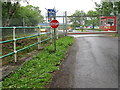
Daily life in Alford Crossways centres on access to dense retail networks and rail links. Five major retail and transport sites lie within practical reach of local residents. You can visit Sainsburys Cranleigh, Co-op Cranleigh, and M&S Alford BP for weekly groceries and household goods. These supermarkets are located in Cranleigh and Milford, both considered nearby amenities. Residents do not need to travel long distances for essential shopping. The presence of a Co-op and Sainsburys within the immediate catchment ensures daily convenience. Rail connections via Witley and Milford Railway Station open up wider regional journeys. You will access leisure activities at Milford Leisure Centre or similar facilities in Cranleigh. Dining out involves travelling to towns like Cranleigh where restaurants cluster around the High Street. The lifestyle is defined by car independence and short bus trips into Cranleigh. Parks and green spaces are accessible via the surrounding countryside rather than large municipal parks. The area offers a village-store-access model for those without cars.
Amenities
Schools
Families moving to Alford Crossways have one primary educational option immediately neighbouring the area. Jigsaw CABAS School operates within walking or short drive distance. This institution is a specialist school serving children with complex needs. The school holds an Outstanding Ofsted rating. This designation confirms the provision of high-quality education suitable for the diverse abilities housed within. The presence of a special needs college reflects the specific community requirements rather than standard comprehensive schooling needs. You will not find a cluster of standard primary or secondary academies listed in the immediate vicinity. Parents must look further afield for mainstream secondary education. The area suits families residing in or sending adult children to this specific facility. The Outstanding rating ensures top-tier support and learning outcomes. However, the single school entry limits the variety of compulsory education choices. Families should plan their future moves around the catchment or specialise area for Jigsaw CABAS School.
| Rank | School | Type | Entry gender | Ages |
|---|
Explore more schools in this area
Go to Schools tabDemographics
The community profile of Alford Crossways reflects a mature demographic. The median age in the area is 70 years old. This indicates a population heavily weighted towards older residents. Most households consist of individuals or couples rather than large families with young children. Home ownership is extremely high, with 75% of residents owning their property. This figure signals a long-standing community where permanent residents have established deep roots. The area does not cater primarily to transient tenant populations. You will encounter a stable environment where generations may overlap within the same neighbourhood. The accommodation types generally consist of terraced Victorian homes and converted manor units typical of this age group. There is little indication of recent student influxes or young professional movement. The demographic structure suggests a settlement designed for retirement or delayed moving plans. Families seeking Victorian gardens and heritage properties often find alignment here. The high ownership rate reduces the noise associated with rental turnover and new tenant arrivals.
Household Size
Accommodation Type
Tenure
Ethnic Group
Religion
Household Composition
Age
Household Deprivation
NS-SEC
Explore more demographic insights in this area
Go to Demographics tabPlanning
Planning Constraints
- Crime RiskPremium