Area Overview for Adderbury, Bloxham & Bodicote Ward
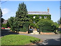
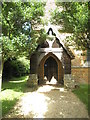
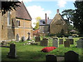
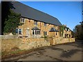
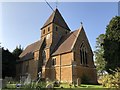
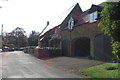
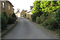
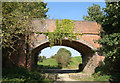
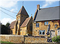
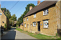
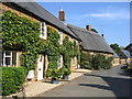
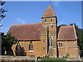
Photos of Adderbury, Bloxham & Bodicote Ward
Area Information
Living in Adderbury, Bloxham & Bodicote Ward offers a settled environment characterised by stable demographics and modern infrastructure. This district encompasses 31.3 square kilometres across Headington Parish and includes the villages of Adderbury, Bloxham, and Bodicote. The population totals 2,864 residents, creating a relatively low-density community where the pace of life moves at a gentle rhythm. Despite its size, the ward maintains a compact footprint that encourages residents to know their neighbours well. Daily life here revolves around quiet villages accessible via local lanes, with properties often situated within green surroundings rather than dense urban centres. The area balances rural charm with the practical necessities of modern living, supported by high-speed digital networks. You will find that the community is deep-rooted, with a strong sense of locality maintained across the different settlements. This district represents a pragmatic choice for those seeking residential stability without the constraints of city living. The specific mix of villages within such a defined geographic area means you enjoy the benefits of clustering amenities while retaining distinct village identities for each settlement.
- Area Type
- District Borough Unitary Ward
- Area Size
- 31.3 km²
- Population
- 2864
- Population Density
- 1103 people/km²
Demographics
The community in Adderbury, Bloxham & Bodicote Ward reflects a settled population with significant tenure stability. Seven out of every ten residents own their homes outright or with a mortgage, contributing a 77% home ownership rate to the local statistics. This high figure indicates a neighbourhood where long-term settlement is the norm rather than the exception. The median age of the population is 70 years, suggesting a community dominated by older generation residents who have likely lived in these homes for decades. You will not find a youthful or rapidly shifting demographic profile here, but rather a steady cohort focused on established living arrangements. While specific breakdowns for household composition, accommodation types, predominant ethnic groups, and religion are not detailed in this dataset, the overarching picture points to a homogeneous community structure defined by age and tenure rather than transient diversity. The low population density of 1,103 people per square kilometre further reinforces the perception of spacious, individual-focused living rather than crowded communal housing. This demographic reality means that local services and community groups cater primarily to the needs of mature homeowners.
Household Size
Accommodation Type
Tenure
Ethnic Group
Religion
Household Composition
Age
Household Deprivation
NS-SEC
Explore more demographic insights in this area
Go to Demographics tabPlanning
Planning Constraints
- Flood RiskPremium
- Ramsar Wetland SitesPremium
- Area of Outstanding Natural BeautyPremium
- Protected Nature ReservePremium
- Protected WoodlandPremium
- Crime RiskPremium