Area Overview for Adderbury
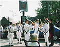
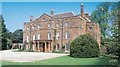
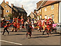
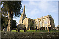
Photos of Adderbury
Area Information
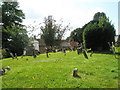
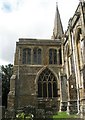
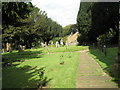
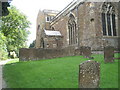
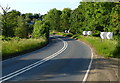
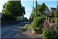
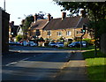
Adderbury is a civil parish situated in the UK with a distinct rural character. The area covers 13.0 km², providing a relatively compact living space that defines the local landscape. You will find a community where daily life moves at a measured pace, distinct from the congestion of larger urban centres. The town centre serves as the focal point, offering local conveniences such as the village shops and pubs that have historically defined this settlement. Living in Adderbury means accepting a lifestyle that prioritises quiet and space over high-density urban infrastructure. The parish boundaries enclose a mix of developed residential areas and open green spaces, creating a defined sense of locality. Residents often rely on the local hub for social interaction, though the small size of the parish suggests limited large-scale commercial variety. Your day-to-day existence here involves navigating a tight-knit environment where neighbours know one another well. The compactness of the 13.0 km² footprint means travel within the parish is generally short, but accessing broader regional amenities requires a car or reliable public transport links. This area is not designed for large families seeking extensive schools or hospitals within walking distance, but those seeking a specific village atmosphere will find it suits their needs.
- Area Type
- Parish
- Area Size
- 13.0 km²
- Population
- Not available
- Population Density
- Not available
Demographics
The community profile in Adderbury reflects an established resident base with limited recent growth. Data indicates a median age of 70 years, signalling a population skewed significantly towards older adults and retirees. This age distribution heavily influences the character of the neighbourhood, where empty nesters and pensioners form the core of society. The figure of 78% home ownership stands out as a key marker of demographic stability. Such a high proportion of owner-occupiers suggests low household turnover and a long-term investment in the properties rather than a transient rental market. Accommodation types within this demographic profile are likely dominated by family homes that have accommodated previous generations. The absence of specific data on household composition or predominant ethnic groups indicates a historically consistent community structure. For you, this translates to an environment where neighbours have established deep roots in the parish. The low rate of social rental housing implies that finding a buy-to-let property may be more difficult than in high-growth hubs. Quality of life is anchored by this stability, with fewer disruptive changes to the street layout or local resident interactions. You will be integrating into a settled group rather than a fluid, shifting population.
Household Size
Accommodation Type
Tenure
Ethnic Group
Religion
Household Composition
Age
Household Deprivation
NS-SEC
Explore more demographic insights in this area
Go to Demographics tabPlanning
Planning Constraints
- Flood RiskPremium
- Ramsar Wetland SitesPremium
- Area of Outstanding Natural BeautyPremium
- Protected Nature ReservePremium
- Protected WoodlandPremium
- Crime RiskPremium