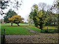
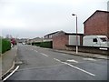
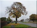
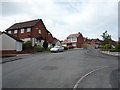
Area Overview for Yewdale Ward
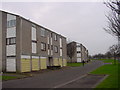
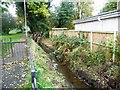
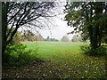
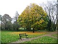
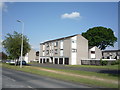
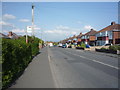
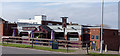
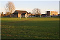
Photos of Yewdale Ward
Area Information
Living in Yewdale Ward offers a quiet residential experience within the Cumberland unitary authority area in North West England. This electoral ward sits just outside Carlisle, positioning it as a distinct community for those seeking proximity to a city without city-centre noise. You will find yourself in a small district where the population stands at 1,306 residents spread across just 1.65 square kilometres. This limited land area creates a compact neighbourhood where properties are relatively close together, yet the ward retains a defined rural character. The wards boundaries are shaped by significant natural and man-made features, specifically a river and key transport routes which form the perimeter of this community. For a prospective homebuyer, the scale of Yewdale Ward means you will encounter a tightly knit environment rather than a sprawling urban expanse. The density here is notable, with 850 people living per square kilometre, which indicates a populated feel without the pressures of a major metropolis. Your daily life involves navigating an area where geography dictates the layout of the district. The coordinates place you south-west of Carlisle, providing a solid base for exploring the wider North West. When you consider homes in Yewdale, you are entering a specific zone defined by its electrical ward status and its connection to the broader Cumberland infrastructure. This area functions as a stable community unit within the larger administrative structure of the region.
- Area Type
- District Borough Unitary Ward
- Area Size
- 1.6 km²
- Population
- 1306
- Population Density
- 836 people/km²
Demographics
The community profile of Yewdale Ward is defined by an older demographic and a high rate of established home ownership. You will find that the median age for residents is 70 years, meaning the population skews significantly towards retirees rather than young families or working-age individuals. This age profile suggests a quiet atmosphere where noise levels are generally low and social interactions tend to be neighbourly and settled. Eighty-four per cent of households in this ward own their homes, a figure that reflects long-term stability within the community. This high ownership level means you are more likely to meet residents who have lived in the same street for many years. The household composition data indicates a fixed demographic structure with no fluctuating rental markets or transient populations. Because the population density reaches 836 people per square kilometre, the community feels present and active despite the smaller total population count. The absence of a listed predominant ethnic group or religious majority in the current statistics implies a homogenous community or sufficiently balanced diversity that no single group dominates the census count. When you look at the most common age range, the data simply categorises the entire population as "Total", reinforcing that age is the primary descriptor for the area's character. Living here means engaging with a settled group of people who value the stability of their current residences. The low median age directly impacts the social fabric, creating an environment where几大 generations may overlap but the dominant energy belongs to the mature residents.
Household Size
Accommodation Type
Tenure
Ethnic Group
Religion
Household Composition
Age
Household Deprivation
NS-SEC
Explore more demographic insights in this area
Go to Demographics tabPlanning
Planning Constraints
- Flood RiskPremium
- Ramsar Wetland SitesPremium
- Area of Outstanding Natural BeautyPremium
- Protected Nature ReservePremium
- Protected WoodlandPremium