Area Overview for Wrenbury Ward
Photos of Wrenbury Ward

Area Information
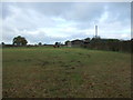
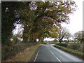
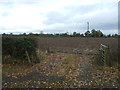
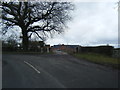
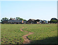
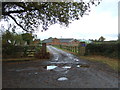
Living in Wrenbury Ward offers a distinct experience defined by its vast, undeveloped landscape. The ward covers an extensive 113.7 km², making it one of the larger residential districts in the Cheshire area. This sheer scale of space shapes daily life, providing residents with significant proximity to open countryside rather than dense urban sprawl. You will find that your view from the window is likely to include rolling fields or hedgerows rather than high-rise blocks. The area sits within the unitary borough structure, which means local governance operates under specific regional frameworks designed to manage land use and community services efficiently. When you consider moving here, you are entering a community where space is the primary commodity. The wide expanse of the ward influences transport choices and language barriers, as it serves as a giant semi-rural pocket within a broader county context. Daily commutes often involve navigating larger distances to reach main employment hubs because the ward itself is not densely packed with workplaces. The environment feels quieter and more isolated compared to nearby towns, which suits those seeking a slower pace of life. You trade the convenience of a bustling city centre for the benefit of lower population density and greater room to breathe. This layout is ideal for outdoor enthusiasts who value wide-open spaces over frequent public entertainment venues located within close walking distance. You should understand that living in Wrenbury Ward means embracing a lifestyle where travel time is a regular part of the routine. The lack of internal urbanisation means services are sourced from the surrounding towns rather than generated within the ward boundaries. This structure creates a reliance on cars for most essential trips, from grocery shopping to medical appointments. The vast area size also contributes to a community feel that can sometimes feel insular compared to larger urban neighbourhoods. However, this isolation is exactly what defines the region's character and attracts those looking to escape standard city living pressures. Your home will be situated in a setting that prioritises natural preservation over rapid development.
- Area Type
- District Borough Unitary Ward
- Area Size
- 113.7 km²
- Population
- Not available
- Population Density
- Not available
Demographics
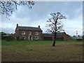
The community within Wrenbury Ward is notably older than the national average, reflecting a specific demographic preference for retirement or semi-retirement living. The median age for residents is 70, which indicates a population skewed heavily towards the elderly. You will encounter a neighbourhood where intergenerational mixing is less common than in urban centres. The most common age range profile mirrors this concentration, creating a stable but homogenous social structure. This age profile suggests a community that prioritises accessibility, quiet streets, and proximity to healthcare facilities over industrial noise or nightlife. Home ownership in Wrenbury Ward stands at a robust 76%, which is a significant indicator of long-term stability and wealth accumulation among residents. This level of ownership is considerably higher than in many parts of the country where rental markets dominate. You are highly likely to find that the people you speak to on the bus or in local shops have lived in their properties for decades. This high rate of home ownership implies a community invested in the local asset base rather than transient professionals seeking short-term rentals. The stability of these long-term owners often translates into a neighbourhood that resists rapid change or disruptive development projects. Accommodation type data shows the ward aligns with its owner-occupied demographic statistics. While the specific breakdown of house styles is not detailed in the demographic records, the high ownership rate strongly suggests a prevalence of detached or semi-detached homes typical of rural and semi-rural English settings. You can expect the housing stock to be well-established rather than comprised of recent builds or temporary accommodations. The household composition and predominant ethnic group statistics are recorded as total fields in the available records, meaning no specific diversity metrics are broken out beyond these aggregate categories. This lack of detailed ethnic and religious data does not diminish the area's character but simply reflects the statistical limitations of the current records for this specific ward. The overall impression from the demographic data is one of a settled, older population. You are looking at an area where families with young children might be less frequent than empty nesters or retirees. This demographic reality affects local business offerings, which tend to cater to mature consumers rather than the needs of a young urban workforce. When you evaluate life in Wrenbury Ward, you are evaluating a community designed for and inhabited by those who have already completed the early stage of their adult lives. The 76% ownership rate is the single strongest fact defining this social landscape, confirming that residents are building equity rather than seeking flexibility.
Household Size
Accommodation Type
Tenure
Ethnic Group
Religion
Household Composition
Age
Household Deprivation
NS-SEC
Explore more demographic insights in this area
Go to Demographics tabPlanning
Planning Constraints
- Flood RiskPremium
- Ramsar Wetland SitesPremium
- Area of Outstanding Natural BeautyPremium
- Protected Nature ReservePremium
- Protected WoodlandPremium
- Crime RiskPremium