Area Overview for Wrea Green with Westby Ward
Photos of Wrea Green with Westby Ward
Area Information
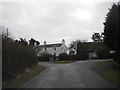
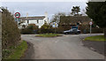
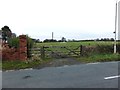
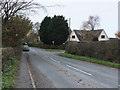
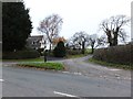
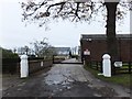
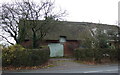
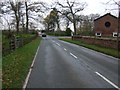
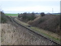
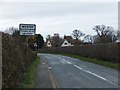
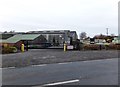
Living in Wrea Green with Westby Ward offers a distinctly rural experience within England. This district-borough-unitary-ward spans 32.5 km², providing ample space but limiting urban conveniences. The area lacks an Area of Outstanding Natural Beauty designation, meaning there are no blanket planning constraints preventing development across the entire landscape. Instead, residents must navigate specific local planning issues, such as the presence of Ramsar wetland sites which introduce particular environmental protections. You will experience a quieter life defined by open spaces rather than dense city blocks. The moniker 'Wrea Green with Westby Ward' describes an entity that functions as a ward rather than a traditionally named village core. This administrative structure suggests a focus on governance and representation over a singular commercial centre. If you seek a location characterised by wide-open spaces and a lack of heavy industrial zoning within the ward boundaries, this area fits that description. However, the absence of protected status for AONB or general nature reserves indicates that while the land exists, it does not carry the highest level of statutory conservation protection found in more restricted zones. Furthermore, the area size means distances between amenities can be significant, as no shops or transport hubs are listed within the provided data. You must be prepared for a lifestyle where daily errands may require travel beyond the 32.5 km² boundary. The lack of detailed local geography points to a need for independent verification of local landmarks or specific neighbourhood features. Regardless, the factual parameters remain clear: you are entering a jurisdiction of moderate size with specific environmental warnings regarding wetlands. This clarity allows you to assess the land's potential against your personal requirements without hidden complexities.
- Area Type
- District Borough Unitary Ward
- Area Size
- 32.5 km²
- Population
- Not available
- Population Density
- Not available
Demographics
The community in Wrea Green with Westby Ward displays a demographic profile that skews significantly towards older age. The median age stands at 70 years, confirming that the population centre is comprised predominantly of senior residents. This high median age suggests that the area may not possess the youthful vibrancy typically found in urban centres or commuter belts. Consequently, services tailored to young families or active teenagers are likely absent, given the age distribution data. The most common age range is recorded simply as 'Total', which implies a broad distribution without a specific youthful peak. Home ownership stands at a remarkable 85 per cent, indicating that the vast majority of households have purchased their properties outright or via mortgage rather than renting. This high rate of ownership typically accompanies areas with retired populations or those built during periods of stable housing markets. Regarding diversity and household composition, the data records ethnicity and religion as 'Total', suggesting a standardised or undifferentiated mix rather than a specific majority minority dynamic. The household composition data is similarly general, labelled as 'Total'. You can expect a resident base where long-term tenure is the norm. The 85 per cent ownership figure reinforces the idea that financial exchange and property accumulation are central to the local history. For a buyer, this translates into an area where neighbours are likely to be settled residents who have stayed for decades. The lack of granular breakdowns for household type or income deprivation means you cannot make specific assumptions about multi-generational living or student housing. The picture is one of stability characterised by age and property ownership rather than demographic fluidity.
Household Size
Accommodation Type
Tenure
Ethnic Group
Religion
Household Composition
Age
Household Deprivation
NS-SEC
Explore more demographic insights in this area
Go to Demographics tabPlanning
Planning Constraints
- Flood RiskPremium
- Ramsar Wetland SitesPremium
- Area of Outstanding Natural BeautyPremium
- Protected Nature ReservePremium
- Protected WoodlandPremium
- Crime RiskPremium