Area Overview for Worsthorne
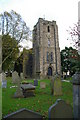
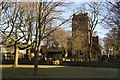
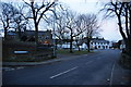
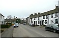
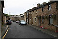
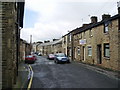
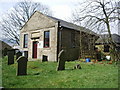
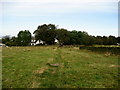
Photos of Worsthorne

Area Information
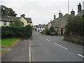
Living in Worsthorne means settling into a distinct built-up area covering 25.5 hectares in England. This locality functions as a established residential zone where daily life revolves around practical amenities and reliable transport links. The area sits within the broader Burnley region, connecting residents to larger urban centres while maintaining its own character. You will find a community defined by stability, with a high proportion of long-term residents who have taken roots here. The layout supports a pace of life suited to families and retirees alike, offering a blend of quiet residential streets and accessible commercial hubs. When you walk through Worsthorne, you encounter a neighbourhood that prioritises convenience and connectivity. The area's size allows for easy navigation without feeling isolated from the wider town centre. Proximity to Burnley places you minutes away from major railway stations and retail outlets. This balance between local charm and urban accessibility defines the experience for anyone considering homes in Worsthorne. The setting provides a solid foundation for domestic life, backed by robust digital infrastructure and strong community bonds. Your daily commute or shopping trip benefits from this strategic positioning within Lancashire.
- Area Type
- Built Up Area 250
- Area Size
- 25.5 hectares
- Population
- Not available
- Population Density
- Not available
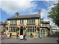
Your daily lifestyle in Worsthorne is shaped by practical amenities located within easy reach. There are five retail points available, including a Spar, Tesco Burnley, and another Spar outlet. These supermarkets satisfy your weekly grocery shopping needs without requiring a long drive into the city centre. The availability of these specific shops supports a self-contained routine where you can stock up on essentials quickly. You will find that the retail density supports a convenient, walkable or short-drive shopping experience. Transport links further enhance your lifestyle convenience through five nearby rail stations. Burnley Central Railway Station, Burnley Manchester Road Railway Station, and Burnley Barracks Railway Station provide rapid access to wider Lancashire and beyond. With five stations in close proximity, your commute times remain manageable regardless of your destination. This rail network is highly beneficial if you work in Greater Manchester or need to travel regularly. The combination of local supermarkets and multiple railway hubs creates a practical living environment. You enjoy the quiet of residential life yet remain minutes away from major transport arteries and retail services.
Amenities
Schools
Families considering the education options near Worsthorne have access to a local primary facility that meets high standards. Worsthorne Primary School is situated nearby and currently holds a 'good' Ofsted rating. This designation indicates that the school delivers consistent quality in teaching and pupil outcomes. While the immediate vicinity offers just one listed primary institution, this single rated school serves as a key focal point for local education. The presence of a school with a confirmed good rating provides reassurance for parents within the community. It suggests that children living in Worsthorne have direct access to an institution recognised for effective education. Although secondary or further education options are not listed in the immediate data, the existence of a well-regarded primary school anchors the area's educational provision. You can expect a learning environment that supports the younger residents of Worsthorne without the need to travel far for primary schooling. The consolidation of educational focus in one main local school simplifies the catchment area for families settling here.
| Rank | School | Type | Entry gender | Ages |
|---|
Explore more schools in this area
Go to Schools tabDemographics
The community profile in Worsthorne is dominated by an older population, with a median age of 70 residents. This demographic skew is significant when evaluating the neighbourhood's character and services. You are entering an area where the most common age bracket aligns with retirees and long-term former residents. Consequently, the street scene reflects a generation that has outgrown active career moves but retains deep local knowledge and investment in the area. Home ownership stands at an impressive 85% within Worsthorne, indicating a stable, owner-occupied market rather than a volatile rental landscape. This high rate of ownership suggests that neighbours often stay in their properties for decades, fostering a sense of permanence. While specific data on accommodation types and household composition totals are noted in records, the overwhelming statistic is clear: most people here own their freehold or leasehold homes. This structure supports property values and creates a quiet, invested community environment where residents take pride in their local surroundings.
Household Size
Accommodation Type
Tenure
Ethnic Group
Religion
Household Composition
Age
Household Deprivation
NS-SEC
Explore more demographic insights in this area
Go to Demographics tabPlanning
Planning Constraints
- Crime RiskPremium