Area Overview for Worsley Mesnes Ward
Photos of Worsley Mesnes Ward


Area Information
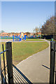
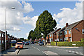
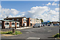
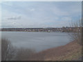
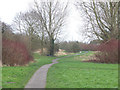
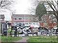
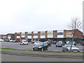
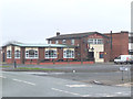
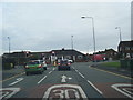
Living in Worsley Mesnes Ward offers a distinct experience within the Metropolitan Borough of Wigan. This district ward spans 6.1 km² and holds a small resident population of 1,377 people. Historical records show the broader ward had a population of 11,974 in 2011, though current figures indicate a smaller, more concentrated community today. The area sits at approximately 53.540°N 2.6310°W, historically forming part of Lancashire before its current administrative status. Worsley Mesnes Drive serves as the primary thoroughfare, connecting the main housing estate. In 2015, this road received WRTL Luma LED streetlights to improve visibility and security. Residents enjoy a low-density environment with 225 people per km², ensuring space between homes. The location functions as a quiet suburb with clear road networks. You will find that daily life here revolves around local streets and the main Drive. The area's layout supports a settled pace of living. Prospective buyers seeking a specific size of community will find Worsley Mesnes matches that need precisely. The ward's boundaries and historical context provide a stable backdrop for modern living. Understanding the physical layout helps you navigate the estate efficiently.
- Area Type
- District Borough Unitary Ward
- Area Size
- 6.1 km²
- Population
- 1377
- Population Density
- 225 people/km²
Demographics
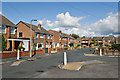
The community profile of Worsley Mesnes Ward reflects an older demographic landscape. The median age in the ward stands at 70 years, making it one of the older districts in the region. This age distribution suggests a population dominated by retirees who have settled in the area for many years. Home ownership rates are notably high, with 64% of residents owning their properties outright. This statistic highlights a traditional, established community where families often build long-term roots. Accommodation types remain stable without significant shifts toward diverse structures. The area lacks recent construction booms or large flatted developments within its core estate. You will encounter a neighbourhood character defined by permanence rather than transient living situations. Households are likely multi-generational or empty-nester units given the age profile. The high ownership percentage contributes to community investment and local stability. This demographic mix creates a quiet residential environment where neighbours know their counterparts for decades. When considering who lives here, you see a clear preference for established homeownership over renting. The absence of younger age groups in the primary data indicates limited student presence or young professional influx.
Household Size
Accommodation Type
Tenure
Ethnic Group
Religion
Household Composition
Age
Household Deprivation
NS-SEC
Explore more demographic insights in this area
Go to Demographics tabPlanning
Planning Constraints
- Flood RiskPremium
- Ramsar Wetland SitesPremium
- Area of Outstanding Natural BeautyPremium
- Protected Nature ReservePremium
- Protected WoodlandPremium
- Crime RiskPremium