Area Overview for Worsley
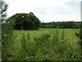
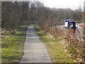
Photos of Worsley


Area Information
Worsley is a compact built-up area in England, covering just 2.9 km², yet it offers a distinct character shaped by its demographics and infrastructure. With a median age of 70, the community is predominantly older, suggesting a settled population with long-term ties to the area. Home ownership is high, at 81%, indicating a strong presence of owner-occupied properties. Daily life here is influenced by proximity to essential services: rail stations, retail hubs, and schools. The area’s size means it is tightly knit, with amenities within practical reach. Residents benefit from excellent broadband connectivity, scoring 100, and reliable mobile coverage. While Worsley lacks the density of larger cities, its accessibility to Manchester’s City Airport and nearby transport links makes it a practical choice for those balancing local convenience with regional connectivity. The mix of primary schools, including St Andrew’s CofE Primary School with an outstanding Ofsted rating, supports families, while independent and special schools cater to diverse educational needs. This blend of factors creates a community where practicality and accessibility are prioritised.
- Area Type
- Built Up Area 250
- Area Size
- 2.9 km²
- Population
- Not available
- Population Density
- Not available
Worsley’s lifestyle is shaped by its accessible amenities. Retail options include Asda Worsley, Sainsburys Boothstown, and Co-op Ellenbrook, providing essential shopping within walking distance. The area’s rail and metro stations, such as Moorside and Barton Dock Road, connect residents to cultural and leisure opportunities in Manchester. The proximity to Manchester’s City Airport adds convenience for frequent travellers. Parks and open spaces are not explicitly listed in the data, but the area’s compact size suggests community green spaces are nearby. The mix of retail, transport, and regional connectivity creates a practical, convenient lifestyle. Residents can enjoy local shopping, easy travel, and access to larger urban amenities without long commutes, balancing suburban tranquillity with urban accessibility.
Amenities
Schools
Worsley’s schools include a range of primary and specialist institutions. St Andrew’s CofE Primary School, with an outstanding Ofsted rating, provides high-quality education for younger children, while Boothstown Methodist Primary School offers a more traditional primary education. St Mark’s CofE Primary School, rated good, adds to the options for families seeking state-funded schooling. Independent education is available at Bridgewater School, which may appeal to those seeking alternative curricula. Highlea Secondary School, a special school, caters to students with specific needs, ensuring a comprehensive educational landscape. The presence of both state and independent schools reflects the area’s diversity, allowing families to choose between public and private education. This variety supports different family priorities, from academic excellence to tailored support for students with additional requirements.
| Rank | A + A* % | School | Type | Entry gender | Ages |
|---|---|---|---|---|---|
| 1 | N/A | St Andrew's CofE Primary School | primary | N/A | N/A |
| 2 | N/A | Boothstown Methodist Primary School | primary | N/A | N/A |
| 3 | N/A | St Mark's CofE Primary School | primary | N/A | N/A |
| 4 | N/A | Bridgewater School | independent | N/A | N/A |
| 5 | N/A | Highlea Secondary School | special | N/A | N/A |
Explore more schools in this area
Go to Schools tabDemographics
Worsley’s population is defined by its median age of 70, the highest in the dataset, indicating a community largely composed of older residents. This suggests a demographic profile where retirement and long-term residency are common. Home ownership is robust at 81%, reflecting a stable housing market with a focus on owner-occupied properties. The data does not specify household types or ethnic diversity, but the high home ownership rate implies a settled population with fewer transient residents. The area’s age profile may influence local services, with healthcare and community amenities likely tailored to older adults. While the data does not quantify deprivation levels, the high proportion of homeowners and the presence of essential amenities suggest a generally stable quality of life. However, the lack of detailed demographic breakdowns means broader conclusions about diversity or generational mix remain unconfirmed.
Household Size
Accommodation Type
Tenure
Ethnic Group
Religion
Household Composition
Age
Household Deprivation
NS-SEC
Explore more demographic insights in this area
Go to Demographics tabPlanning
Planning Constraints
- Crime RiskLocked