Area Overview for WN8 9EZ
Photos of WN8 9EZ
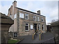
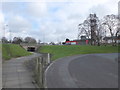
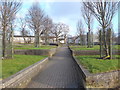
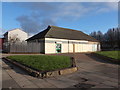
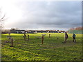
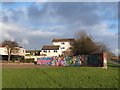
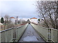
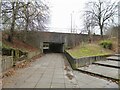
25 photos from this area
Area Information
Key information about the WN8 9EZ including its size, population, and administrative classification.
- Area Type
- Postcode
- Area Size
- 1.1 hectares
- Population
- 1618
- Population Density
- 5031 people/km²
House Prices in WN8 9EZ
39
Properties
£55,389
Average Sold Price
£30,000
Lowest Price
£85,000
Highest Price
Showing 39 properties
| Address | Type | Beds | Baths | Last Sale Price | Last Sale Date | |
|---|---|---|---|---|---|---|
| 255 Beechtrees, Digmoor, Skelmersdale, WN8 9EZ | house | - | - | £65,000 | Aug 2021 | |
| 187 Beechtrees, Digmoor, Skelmersdale, WN8 9EZ | Terraced | 4 | 1 | £63,000 | Feb 2021 | |
| 259 Beechtrees, Digmoor, Skelmersdale, WN8 9EZ | house | 3 | - | £38,500 | Oct 2015 | |
| 253 Beechtrees, Digmoor, Skelmersdale, WN8 9EZ | house | 3 | - | £38,000 | Aug 2015 | |
| 175 Beechtrees, Digmoor, Skelmersdale, WN8 9EZ | house | - | - | £85,000 | Jun 2008 | |
| 239 Beechtrees, Digmoor, Skelmersdale, WN8 9EZ | Terraced | 3 | 2 | £51,000 | Feb 2008 | |
| 191 Beechtrees, Digmoor, Skelmersdale, WN8 9EZ | Terraced | 4 | - | £85,000 | Dec 2007 | |
| 257 Beechtrees, Digmoor, Skelmersdale, WN8 9EZ | house | - | - | £43,000 | Sep 2004 | |
| 251 Beechtrees, Digmoor, Skelmersdale, WN8 9EZ | house | 3 | - | £30,000 | Jan 2004 | |
| 161 Beechtrees, Digmoor, Skelmersdale, WN8 9EZ | Terraced | 3 | 1 | - | - |
Page 1 of 4
Energy Efficiency in WN8 9EZ
Amenities
Schools
| Rank | School | Type | Entry gender | Ages |
|---|
Explore more schools in this area
Go to Schools tabDemographics
Household Size
Family (3-5 people)
most common
Accommodation Type
Houses
most common
Tenure
23
majority
Ethnic Group
White
most common
Religion
N/A
most common
Household Composition
N/A
most common
Age
47
median
Adults (30-64 years)
most common
Household Deprivation
N/A
with no deprivation
NS-SEC
11
in Lower managerial occupations
Explore more demographic insights in this area
Go to Demographics tabPlanning
Planning Constraints
- Flood RiskPremium
- Ramsar Wetland SitesPremium
- Area of Outstanding Natural BeautyPremium
- Protected Nature ReservePremium
- Protected WoodlandPremium