Area Overview for WN8 9EF
Photos of WN8 9EF
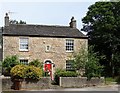
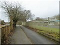
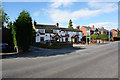
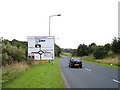
19 photos from this area
Area Information
Key information about the WN8 9EF including its size, population, and administrative classification.
- Area Type
- Postcode
- Area Size
- 1.2 hectares
- Population
- 1426
- Population Density
- 4960 people/km²
House Prices in WN8 9EF
29
Properties
£60,401
Average Sold Price
£11,022
Lowest Price
£110,000
Highest Price
Showing 29 properties
| Address | Type | Beds | Baths | Last Sale Price | Last Sale Date | |
|---|---|---|---|---|---|---|
| 113 Cherrycroft, Skelmersdale, WN8 9EF | Terraced | 3 | 2 | £110,000 | Dec 2022 | |
| 127 Cherrycroft, Skelmersdale, WN8 9EF | Terraced | 2 | 1 | £90,000 | Oct 2022 | |
| 135 Cherrycroft, Skelmersdale, WN8 9EF | house | - | - | £65,000 | Sep 2021 | |
| 133 Cherrycroft, Skelmersdale, WN8 9EF | house | - | - | £110,000 | Sep 2021 | |
| 115 Cherrycroft, Skelmersdale, WN8 9EF | Terraced | 3 | 1 | £69,000 | Nov 2019 | |
| 121 Cherrycroft, Skelmersdale, WN8 9EF | Terraced | 3 | 1 | £56,000 | Sep 2018 | |
| 147 Cherrycroft, Skelmersdale, WN8 9EF | house | 3 | - | £49,950 | May 2015 | |
| 141 Cherrycroft, Skelmersdale, WN8 9EF | house | - | - | £50,000 | Feb 2014 | |
| 97 Cherrycroft, Skelmersdale, WN8 9EF | Terraced | 3 | 1 | £76,000 | Mar 2010 | |
| 151 Cherrycroft, Skelmersdale, WN8 9EF | house | - | - | £60,000 | Nov 2009 |
Page 1 of 3
Energy Efficiency in WN8 9EF
Amenities
Schools
| Rank | School | Type | Entry gender | Ages |
|---|
Explore more schools in this area
Go to Schools tabDemographics
Household Size
Family (3-5 people)
most common
Accommodation Type
Houses
most common
Tenure
43
majority
Ethnic Group
White
most common
Religion
N/A
most common
Household Composition
N/A
most common
Age
47
median
Adults (30-64 years)
most common
Household Deprivation
N/A
with no deprivation
NS-SEC
15
in Lower managerial occupations
Explore more demographic insights in this area
Go to Demographics tabPlanning
Planning Constraints
- Flood RiskPremium
- Ramsar Wetland SitesPremium
- Area of Outstanding Natural BeautyPremium
- Protected Nature ReservePremium
- Protected WoodlandPremium