Area Overview for WN8 9DR
Photos of WN8 9DR
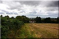

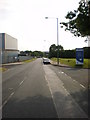
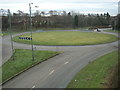
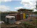


27 photos from this area
Area Information
Key information about the WN8 9DR including its size, population, and administrative classification.
- Area Type
- Postcode
- Area Size
- 2.2 hectares
- Population
- 1426
- Population Density
- 4960 people/km²
House Prices in WN8 9DR
64
Properties
£69,332
Average Sold Price
£16,000
Lowest Price
£117,000
Highest Price
Showing 64 properties
| Address | Type | Beds | Baths | Last Sale Price | Last Sale Date | |
|---|---|---|---|---|---|---|
| 57 Carfield, Skelmersdale, WN8 9DR | Terraced | 3 | 2 | £117,000 | Jun 2025 | |
| 113 Carfield, Skelmersdale, WN8 9DR | house | - | - | £70,000 | Dec 2024 | |
| 3 Carfield, Skelmersdale, WN8 9DR | Terraced | 3 | 2 | £75,000 | Aug 2023 | |
| 35 Carfield, Skelmersdale, WN8 9DR | Terraced | 3 | 2 | £98,000 | May 2023 | |
| 41 Carfield, Skelmersdale, WN8 9DR | Terraced | 3 | 2 | £97,500 | Sep 2022 | |
| 37 Carfield, Skelmersdale, WN8 9DR | house | 3 | 2 | £100,000 | Jul 2022 | |
| 47 Carfield, Skelmersdale, WN8 9DR | house | - | - | £65,000 | Oct 2021 | |
| 33 Carfield, Skelmersdale, WN8 9DR | house | - | - | £73,000 | Aug 2021 | |
| 25 Carfield, Skelmersdale, WN8 9DR | house | - | - | £84,000 | May 2021 | |
| 125 Carfield, Skelmersdale, WN8 9DR | house | - | - | £89,950 | Nov 2020 |
Page 1 of 7
Energy Efficiency in WN8 9DR
Amenities
Schools
| Rank | School | Type | Entry gender | Ages |
|---|
Explore more schools in this area
Go to Schools tabDemographics
Household Size
Family (3-5 people)
most common
Accommodation Type
Houses
most common
Tenure
43
majority
Ethnic Group
White
most common
Religion
N/A
most common
Household Composition
N/A
most common
Age
47
median
Adults (30-64 years)
most common
Household Deprivation
N/A
with no deprivation
NS-SEC
15
in Lower managerial occupations
Explore more demographic insights in this area
Go to Demographics tabPlanning
Planning Constraints
- Flood RiskPremium
- Ramsar Wetland SitesPremium
- Area of Outstanding Natural BeautyPremium
- Protected Nature ReservePremium
- Protected WoodlandPremium