Area Overview for WN8 9AL
Photos of WN8 9AL
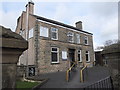
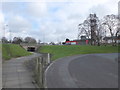
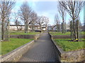
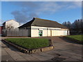

25 photos from this area
Area Information
Key information about the WN8 9AL including its size, population, and administrative classification.
- Area Type
- Postcode
- Area Size
- 2.1 hectares
- Population
- 1618
- Population Density
- 5031 people/km²
House Prices in WN8 9AL
7
Properties
£145,833
Average Sold Price
£70,500
Lowest Price
£285,000
Highest Price
Showing 7 properties
| Address | Type | Beds | Baths | Last Sale Price | Last Sale Date | |
|---|---|---|---|---|---|---|
| 372 Ormskirk Road, Skelmersdale, WN8 9AL | house | 4 | - | £82,000 | Nov 2022 | |
| 378 Ormskirk Road, Skelmersdale, WN8 9AL | house | 3 | 1 | £285,000 | Nov 2021 | |
| 370 Ormskirk Road, Skelmersdale, WN8 9AL | Flat | 2 | 1 | £70,500 | Nov 2017 | |
| 368 Ormskirk Road, Skelmersdale, WN8 9AL | Flat | - | - | - | - | |
| Learn 4 Life Independent School, Quarry Bank Community House, 364 Ormskirk Road, Skelmersdale, WN8 9AL | commercial | - | - | - | - | |
| Quarry Bank Social Club, Ormskirk Road, Skelmersdale, WN8 9AL | commercial | - | - | - | - | |
| 374 Ormskirk Road, Skelmersdale, WN8 9AL | house | - | - | - | - |
Energy Efficiency in WN8 9AL
Amenities
Schools
| Rank | School | Type | Entry gender | Ages |
|---|
Explore more schools in this area
Go to Schools tabDemographics
Household Size
Family (3-5 people)
most common
Accommodation Type
Houses
most common
Tenure
23
majority
Ethnic Group
White
most common
Religion
N/A
most common
Household Composition
N/A
most common
Age
47
median
Adults (30-64 years)
most common
Household Deprivation
N/A
with no deprivation
NS-SEC
11
in Lower managerial occupations
Explore more demographic insights in this area
Go to Demographics tabPlanning
Planning Constraints
- Flood RiskPremium
- Ramsar Wetland SitesPremium
- Area of Outstanding Natural BeautyPremium
- Protected Nature ReservePremium
- Protected WoodlandPremium