Area Overview for WN8 9AJ
Photos of WN8 9AJ
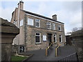
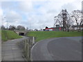
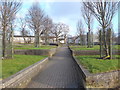
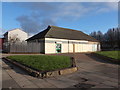
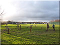
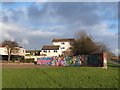
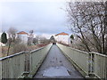
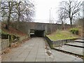
25 photos from this area
Area Information
Key information about the WN8 9AJ including its size, population, and administrative classification.
- Area Type
- Postcode
- Area Size
- 6848 m²
- Population
- 1374
- Population Density
- 4089 people/km²
House Prices in WN8 9AJ
24
Properties
£106,850
Average Sold Price
£45,500
Lowest Price
£192,000
Highest Price
Showing 24 properties
| Address | Type | Beds | Baths | Last Sale Price | Last Sale Date | |
|---|---|---|---|---|---|---|
| 313 Ormskirk Road, Skelmersdale, WN8 9AJ | Terraced | 2 | 1 | £135,000 | Aug 2024 | |
| 317 Ormskirk Road, Skelmersdale, WN8 9AJ | house | - | - | £127,500 | Jun 2022 | |
| 333 Ormskirk Road, Skelmersdale, WN8 9AJ | Detached | 3 | 3 | £192,000 | Aug 2020 | |
| 309 Ormskirk Road, Skelmersdale, WN8 9AJ | Semi-detached | 2 | 1 | £67,000 | Sep 2019 | |
| 323 Ormskirk Road, Skelmersdale, WN8 9AJ | house | - | - | £84,000 | Oct 2015 | |
| 335 Ormskirk Road, Skelmersdale, WN8 9AJ | house | 3 | - | £155,000 | Nov 2011 | |
| 319 Ormskirk Road, Skelmersdale, WN8 9AJ | house | - | - | £122,500 | Jul 2011 | |
| 331 Ormskirk Road, Skelmersdale, WN8 9AJ | Terraced | - | - | £86,000 | Jun 2007 | |
| 327 Ormskirk Road, Skelmersdale, WN8 9AJ | house | - | - | £54,000 | Jul 2003 | |
| 321 Ormskirk Road, Skelmersdale, WN8 9AJ | Terraced | - | - | £45,500 | Apr 2002 |
Page 1 of 3
Energy Efficiency in WN8 9AJ
Amenities
Schools
| Rank | School | Type | Entry gender | Ages |
|---|
Explore more schools in this area
Go to Schools tabDemographics
Household Size
One person
most common
Accommodation Type
Houses
most common
Tenure
68
majority
Ethnic Group
White
most common
Religion
N/A
most common
Household Composition
N/A
most common
Age
47
median
Adults (30-64 years)
most common
Household Deprivation
N/A
with no deprivation
NS-SEC
20
in Lower managerial occupations
Explore more demographic insights in this area
Go to Demographics tabPlanning
Planning Constraints
- Flood RiskPremium
- Ramsar Wetland SitesPremium
- Area of Outstanding Natural BeautyPremium
- Protected Nature ReservePremium
- Protected WoodlandPremium