Area Overview for WN8 8RL
Photos of WN8 8RL
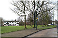
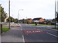


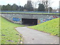
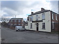

17 photos from this area
Area Information
Key information about the WN8 8RL including its size, population, and administrative classification.
- Area Type
- Postcode
- Area Size
- 1.1 hectares
- Population
- 1098
- Population Density
- 751 people/km²
House Prices in WN8 8RL
21
Properties
£113,654
Average Sold Price
£42,000
Lowest Price
£180,000
Highest Price
Showing 21 properties
| Address | Type | Beds | Baths | Last Sale Price | Last Sale Date | |
|---|---|---|---|---|---|---|
| 2 Delamere Road, Skelmersdale, WN8 8RL | Semi-detached | 3 | 1 | £151,000 | Aug 2024 | |
| 6 Delamere Road, Skelmersdale, WN8 8RL | Semi-detached | 3 | 1 | £176,000 | Apr 2024 | |
| 1 Delamere Road, Skelmersdale, WN8 8RL | Semi-detached | 3 | 1 | £150,000 | Jun 2023 | |
| 20 Delamere Road, Skelmersdale, WN8 8RL | Bungalow | 3 | 1 | £180,000 | Nov 2021 | |
| 26 Delamere Road, Skelmersdale, WN8 8RL | Bungalow | 2 | 1 | £120,000 | Aug 2013 | |
| 28 Delamere Road, Skelmersdale, WN8 8RL | Detached | - | - | £92,000 | Mar 2008 | |
| 11 Delamere Road, Skelmersdale, WN8 8RL | Semi-detached | - | - | £140,000 | Aug 2006 | |
| 7 Delamere Road, Skelmersdale, WN8 8RL | Terraced | - | - | £125,000 | Apr 2005 | |
| 24 Delamere Road, Skelmersdale, WN8 8RL | Detached | - | - | £125,000 | Sep 2004 | |
| 18 Delamere Road, Skelmersdale, WN8 8RL | Detached | - | - | £74,000 | Oct 1998 |
Page 1 of 3
Energy Efficiency in WN8 8RL
Amenities
Schools
| Rank | School | Type | Entry gender | Ages |
|---|
Explore more schools in this area
Go to Schools tabDemographics
Household Size
Two person
most common
Accommodation Type
Houses
most common
Tenure
72
majority
Ethnic Group
White
most common
Religion
N/A
most common
Household Composition
N/A
most common
Age
47
median
Adults (30-64 years)
most common
Household Deprivation
N/A
with no deprivation
NS-SEC
23
in Lower managerial occupations
Explore more demographic insights in this area
Go to Demographics tabPlanning
Planning Constraints
- Flood RiskPremium
- Ramsar Wetland SitesPremium
- Area of Outstanding Natural BeautyPremium
- Protected Nature ReservePremium
- Protected WoodlandPremium