Area Overview for WN8 7XB
Photos of WN8 7XB
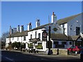
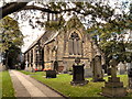
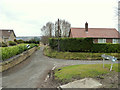
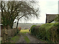
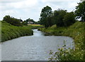
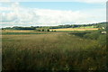
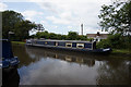
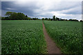
69 photos from this area
Area Information
Key information about the WN8 7XB including its size, population, and administrative classification.
- Area Type
- Postcode
- Area Size
- 10.7 hectares
- Population
- 2025
- Population Density
- 97 people/km²
House Prices in WN8 7XB
16
Properties
£398,667
Average Sold Price
£130,000
Lowest Price
£750,000
Highest Price
Showing 16 properties
| Address | Type | Beds | Baths | Last Sale Price | Last Sale Date | |
|---|---|---|---|---|---|---|
| December Cottage, 5 Back Lane, Newburgh, WN8 7XB | Semi-detached | 3 | 2 | £620,000 | Mar 2024 | |
| Green Acre, Back Lane, Newburgh, WN8 7XB | house | - | - | £750,000 | Jun 2021 | |
| Briarfield, Back Lane, Newburgh, WN8 7XB | Bungalow | 3 | 3 | £515,000 | Aug 2017 | |
| Glebe Cottage, Back Lane, Newburgh, WN8 7XB | Semi-detached | 2 | 1 | £272,500 | Jul 2013 | |
| The New Orchard, Back Lane, Newburgh, WN8 7XB | Detached | - | - | £345,000 | Nov 2006 | |
| Old Orchard, Back Lane, Newburgh, WN8 7XB | Detached | - | - | £542,500 | May 2005 | |
| Hatherlow, Back Lane, Newburgh, WN8 7XB | Detached | - | - | £210,000 | Jun 2004 | |
| Strath Cottage, Back Lane, Newburgh, WN8 7XB | Detached | - | - | £203,000 | Oct 2000 | |
| Ashford House, Back Lane, Newburgh, WN8 7XB | Detached | - | - | £130,000 | Feb 1995 | |
| Brynkerry, Back Lane, Newburgh, WN8 7XB | Detached | - | - | - | - |
Page 1 of 2
Energy Efficiency in WN8 7XB
Amenities
Schools
| Rank | School | Type | Entry gender | Ages |
|---|
Explore more schools in this area
Go to Schools tabDemographics
Household Size
Two person
most common
Accommodation Type
Houses
most common
Tenure
87
majority
Ethnic Group
White
most common
Religion
N/A
most common
Household Composition
N/A
most common
Age
47
median
Adults (30-64 years)
most common
Household Deprivation
N/A
with no deprivation
NS-SEC
45
in Lower managerial occupations
Explore more demographic insights in this area
Go to Demographics tabPlanning
Planning Constraints
- Flood RiskPremium
- Ramsar Wetland SitesPremium
- Area of Outstanding Natural BeautyPremium
- Protected Nature ReservePremium
- Protected WoodlandPremium