Area Overview for WN8 6EU
Photos of WN8 6EU
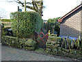
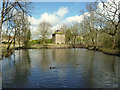
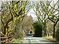
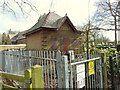
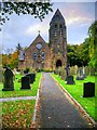
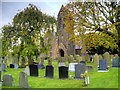
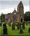
23 photos from this area
Area Information
Key information about the WN8 6EU including its size, population, and administrative classification.
- Area Type
- Postcode
- Area Size
- 5.5 hectares
- Population
- 1879
- Population Density
- 1632 people/km²
House Prices in WN8 6EU
78
Properties
£153,916
Average Sold Price
£55,108
Lowest Price
£265,000
Highest Price
Showing 78 properties
| Address | Type | Beds | Baths | Last Sale Price | Last Sale Date | |
|---|---|---|---|---|---|---|
| 33 Jackfield Way, Skelmersdale, WN8 6EU | Detached | 3 | 2 | £237,000 | Oct 2025 | |
| 43 Jackfield Way, Skelmersdale, WN8 6EU | Detached | 2 | 1 | £195,000 | Sep 2025 | |
| 149 Jackfield Way, Skelmersdale, WN8 6EU | Semi-detached | 3 | 1 | £210,000 | Aug 2025 | |
| 19 Jackfield Way, Skelmersdale, WN8 6EU | Detached | 3 | 2 | £220,000 | Jul 2025 | |
| 29 Jackfield Way, Skelmersdale, WN8 6EU | house | - | - | £170,000 | May 2025 | |
| 101 Jackfield Way, Skelmersdale, WN8 6EU | Semi-detached | 2 | 1 | £85,000 | Dec 2024 | |
| 95 Jackfield Way, Skelmersdale, WN8 6EU | house | - | - | £195,000 | Aug 2024 | |
| 51 Jackfield Way, Skelmersdale, WN8 6EU | Retail | 2 | 2 | £138,000 | Aug 2023 | |
| 75 Jackfield Way, Skelmersdale, WN8 6EU | Detached | 3 | 2 | £265,000 | Jul 2023 | |
| 65 Jackfield Way, Skelmersdale, WN8 6EU | house | - | - | £203,000 | Oct 2021 |
Page 1 of 8
Energy Efficiency in WN8 6EU
Amenities
Schools
| Rank | School | Type | Entry gender | Ages |
|---|
Explore more schools in this area
Go to Schools tabDemographics
Household Size
Family (3-5 people)
most common
Accommodation Type
Houses
most common
Tenure
92
majority
Ethnic Group
White
most common
Religion
N/A
most common
Household Composition
N/A
most common
Age
47
median
Adults (30-64 years)
most common
Household Deprivation
N/A
with no deprivation
NS-SEC
38
in Lower managerial occupations
Explore more demographic insights in this area
Go to Demographics tabPlanning
Planning Constraints
- Flood RiskPremium
- Ramsar Wetland SitesPremium
- Area of Outstanding Natural BeautyPremium
- Protected Nature ReservePremium
- Protected WoodlandPremium