Area Overview for WN7 5EA
Photos of WN7 5EA
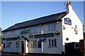
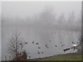
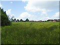
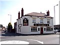
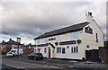
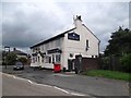
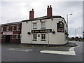
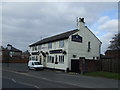
14 photos from this area
Area Information
Key information about the WN7 5EA including its size, population, and administrative classification.
- Area Type
- Postcode
- Area Size
- 1.2 hectares
- Population
- 1584
- Population Density
- 2071 people/km²
House Prices in WN7 5EA
42
Properties
£80,750
Average Sold Price
£12,750
Lowest Price
£122,000
Highest Price
Showing 42 properties
| Address | Type | Beds | Baths | Last Sale Price | Last Sale Date | |
|---|---|---|---|---|---|---|
| 125 Cameron Street, Leigh, WN7 5EA | Terraced | 3 | 1 | £122,000 | Oct 2023 | |
| 111 Cameron Street, Leigh, WN7 5EA | Terraced | 2 | 1 | £96,000 | Sep 2023 | |
| 104 Cameron Street, Leigh, WN7 5EA | Terraced | 2 | 1 | £111,500 | Sep 2022 | |
| 107 Cameron Street, Leigh, WN7 5EA | house | 2 | 1 | £95,000 | Jun 2022 | |
| 101 Cameron Street, Leigh, WN7 5EA | Semi-detached | 3 | 1 | £110,000 | Jun 2022 | |
| 95 Cameron Street, Leigh, WN7 5EA | Terraced | 3 | 2 | £72,000 | Sep 2018 | |
| 123 Cameron Street, Leigh, WN7 5EA | house | 3 | 1 | £79,000 | May 2018 | |
| 99 Cameron Street, Leigh, WN7 5EA | Terraced | 2 | 1 | £44,000 | Sep 2012 | |
| 124 Cameron Street, Leigh, WN7 5EA | house | - | - | £80,000 | Oct 2007 | |
| 90 Cameron Street, Leigh, WN7 5EA | Semi-detached | - | - | £66,000 | Jun 2006 |
Page 1 of 5
Energy Efficiency in WN7 5EA
Amenities
Schools
| Rank | School | Type | Entry gender | Ages |
|---|
Explore more schools in this area
Go to Schools tabDemographics
Household Size
One person
most common
Accommodation Type
Houses
most common
Tenure
50
majority
Ethnic Group
White
most common
Religion
N/A
most common
Household Composition
N/A
most common
Age
47
median
Adults (30-64 years)
most common
Household Deprivation
N/A
with no deprivation
NS-SEC
19
in Lower managerial occupations
Explore more demographic insights in this area
Go to Demographics tabPlanning
Planning Constraints
- Flood RiskPremium
- Ramsar Wetland SitesPremium
- Area of Outstanding Natural BeautyPremium
- Protected Nature ReservePremium
- Protected WoodlandPremium