Area Overview for WN7 5AY
Photos of WN7 5AY
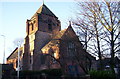
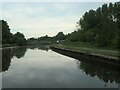
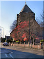
![Springfield Bridge [no 10] from the west in WN7 5AY](https://images.propbar.co.uk/images/geograph/68/88/6888759_120.jpg)
25 photos from this area
Area Information
Key information about the WN7 5AY including its size, population, and administrative classification.
- Area Type
- Postcode
- Area Size
- 1.8 hectares
- Population
- 1584
- Population Density
- 2071 people/km²
House Prices in WN7 5AY
21
Properties
£71,096
Average Sold Price
£31,000
Lowest Price
£121,750
Highest Price
Showing 21 properties
| Address | Type | Beds | Baths | Last Sale Price | Last Sale Date | |
|---|---|---|---|---|---|---|
| 82 Wigan Road, Leigh, WN7 5AY | Retail | 2 | 2 | £121,750 | Jul 2022 | |
| 88 Wigan Road, Leigh, WN7 5AY | Terraced | 2 | 1 | £100,000 | Mar 2022 | |
| 96 Wigan Road, Leigh, WN7 5AY | Terraced | 3 | 1 | £90,000 | Apr 2021 | |
| 66 Wigan Road, Leigh, WN7 5AY | Terraced | 2 | 1 | £74,000 | Nov 2019 | |
| 60 Wigan Road, Leigh, WN7 5AY | Terraced | 3 | 2 | £85,000 | Sep 2018 | |
| 74 Wigan Road, Leigh, WN7 5AY | Terraced | 3 | 1 | £71,500 | Aug 2017 | |
| 80 Wigan Road, Leigh, WN7 5AY | Terraced | 2 | - | £60,000 | Sep 2012 | |
| 92 Wigan Road, Leigh, WN7 5AY | house | 3 | 1 | £74,000 | May 2010 | |
| 84 Wigan Road, Leigh, WN7 5AY | house | - | - | £71,000 | Sep 2007 | |
| 64 Wigan Road, Leigh, WN7 5AY | house | 2 | 1 | £55,000 | Jul 2005 |
Page 1 of 3
Energy Efficiency in WN7 5AY
Amenities
Schools
| Rank | School | Type | Entry gender | Ages |
|---|
Explore more schools in this area
Go to Schools tabDemographics
Household Size
One person
most common
Accommodation Type
Houses
most common
Tenure
50
majority
Ethnic Group
White
most common
Religion
N/A
most common
Household Composition
N/A
most common
Age
47
median
Adults (30-64 years)
most common
Household Deprivation
N/A
with no deprivation
NS-SEC
19
in Lower managerial occupations
Explore more demographic insights in this area
Go to Demographics tabPlanning
Planning Constraints
- Flood RiskPremium
- Ramsar Wetland SitesPremium
- Area of Outstanding Natural BeautyPremium
- Protected Nature ReservePremium
- Protected WoodlandPremium