Area Overview for WN7 4SX
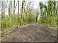
Photos of WN7 4SX

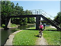
![Springfield Bridge [no 10] from the west in WN7 4SX](https://images.propbar.co.uk/images/geograph/68/88/6888759_120.jpg)


25 photos from this area
Area Information
Key information about the WN7 4SX including its size, population, and administrative classification.
- Area Type
- Postcode
- Area Size
- 1.1 hectares
- Population
- 1505
- Population Density
- 3553 people/km²
House Prices in WN7 4SX
28
Properties
£109,793
Average Sold Price
£49,950
Lowest Price
£195,000
Highest Price
Showing 28 properties
| Address | Type | Beds | Baths | Last Sale Price | Last Sale Date | |
|---|---|---|---|---|---|---|
| 13 Naunton Avenue, Leigh, WN7 4SX | Semi-detached | 3 | 1 | £195,000 | Jul 2023 | |
| 12 Naunton Avenue, Leigh, WN7 4SX | house | - | - | £195,000 | Sep 2022 | |
| 23 Naunton Avenue, Leigh, WN7 4SX | Semi-detached | 2 | 1 | £119,950 | May 2021 | |
| 27 Naunton Avenue, Leigh, WN7 4SX | Semi-detached | 2 | 1 | £105,000 | May 2020 | |
| 17 Naunton Avenue, Leigh, WN7 4SX | Semi-detached | 2 | 1 | £130,000 | Oct 2019 | |
| 10 Naunton Avenue, Leigh, WN7 4SX | Semi-detached | 3 | 1 | £147,500 | Mar 2017 | |
| 22 Naunton Avenue, Leigh, WN7 4SX | Semi-detached | 3 | 2 | £114,000 | Jun 2016 | |
| 25 Naunton Avenue, Leigh, WN7 4SX | Semi-detached | - | - | £82,500 | Dec 2015 | |
| 14 Naunton Avenue, Leigh, WN7 4SX | house | - | - | £126,000 | May 2005 | |
| 21 Naunton Avenue, Leigh, WN7 4SX | Bungalow | 2 | 1 | £82,000 | Feb 2004 |
Page 1 of 3
Energy Efficiency in WN7 4SX
Amenities
Schools
| Rank | School | Type | Entry gender | Ages |
|---|
Explore more schools in this area
Go to Schools tabDemographics
Household Size
Two person
most common
Accommodation Type
Houses
most common
Tenure
77
majority
Ethnic Group
White
most common
Religion
N/A
most common
Household Composition
N/A
most common
Age
47
median
Adults (30-64 years)
most common
Household Deprivation
N/A
with no deprivation
NS-SEC
22
in Lower managerial occupations
Explore more demographic insights in this area
Go to Demographics tabPlanning
Planning Constraints
- Flood RiskPremium
- Ramsar Wetland SitesPremium
- Area of Outstanding Natural BeautyPremium
- Protected Nature ReservePremium
- Protected WoodlandPremium