Area Overview for WN7 4ED
Photos of WN7 4ED


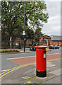
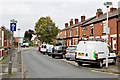
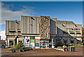
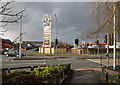

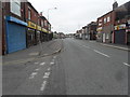
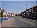
95 photos from this area
Area Information
Key information about the WN7 4ED including its size, population, and administrative classification.
- Area Type
- Postcode
- Area Size
- 3636 m²
- Population
- 1411
- Population Density
- 8142 people/km²
House Prices in WN7 4ED
19
Properties
£60,415
Average Sold Price
£18,000
Lowest Price
£105,000
Highest Price
Showing 19 properties
| Address | Type | Beds | Baths | Last Sale Price | Last Sale Date | |
|---|---|---|---|---|---|---|
| 124 Twist Lane, Leigh, WN7 4ED | Terraced | 2 | 1 | £105,000 | Oct 2024 | |
| 128 Twist Lane, Leigh, WN7 4ED | Terraced | 2 | 1 | £89,000 | Dec 2023 | |
| 136 Twist Lane, Leigh, WN7 4ED | Terraced | 2 | 1 | £55,000 | Oct 2021 | |
| 126 Twist Lane, Leigh, WN7 4ED | Terraced | 3 | 1 | £75,000 | Sep 2019 | |
| 130 Twist Lane, Leigh, WN7 4ED | Terraced | 2 | 1 | £54,000 | Jul 2017 | |
| 152 Twist Lane, Leigh, WN7 4ED | house | - | - | £60,000 | Aug 2008 | |
| 156 Twist Lane, Leigh, WN7 4ED | Terraced | 2 | 1 | £104,000 | Sep 2007 | |
| 144 Twist Lane, Leigh, WN7 4ED | house | - | - | £61,000 | Apr 2006 | |
| 132 Twist Lane, Leigh, WN7 4ED | Semi-detached | - | - | £50,000 | May 2005 | |
| 146 Twist Lane, Leigh, WN7 4ED | Terraced | 3 | 1 | £64,950 | Sep 2004 |
Page 1 of 2
Energy Efficiency in WN7 4ED
Amenities
Schools
| Rank | School | Type | Entry gender | Ages |
|---|
Explore more schools in this area
Go to Schools tabDemographics
Household Size
One person
most common
Accommodation Type
Houses
most common
Tenure
55
majority
Ethnic Group
White
most common
Religion
N/A
most common
Household Composition
N/A
most common
Age
47
median
Adults (30-64 years)
most common
Household Deprivation
N/A
with no deprivation
NS-SEC
19
in Lower managerial occupations
Explore more demographic insights in this area
Go to Demographics tabPlanning
Planning Constraints
- Flood RiskPremium
- Ramsar Wetland SitesPremium
- Area of Outstanding Natural BeautyPremium
- Protected Nature ReservePremium
- Protected WoodlandPremium