Area Overview for WN7 3RA
Photos of WN7 3RA
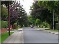
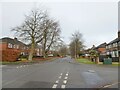
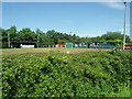
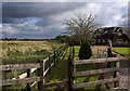
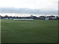
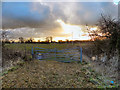
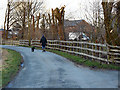
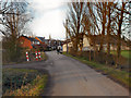
13 photos from this area
Area Information
Key information about the WN7 3RA including its size, population, and administrative classification.
- Area Type
- Postcode
- Area Size
- 7630 m²
- Population
- 1484
- Population Density
- 1097 people/km²
House Prices in WN7 3RA
19
Properties
£247,382
Average Sold Price
£7,450
Lowest Price
£358,000
Highest Price
Showing 19 properties
| Address | Type | Beds | Baths | Last Sale Price | Last Sale Date | |
|---|---|---|---|---|---|---|
| 18 Beckfield Close, Leigh, WN7 3RA | Detached | 4 | 4 | £325,000 | Mar 2025 | |
| 1 Beckfield Close, Leigh, WN7 3RA | house | - | - | £7,450 | Apr 2023 | |
| 14 Beckfield Close, Leigh, WN7 3RA | Retail | 4 | 4 | £275,000 | Aug 2022 | |
| 15 Beckfield Close, Leigh, WN7 3RA | Detached | 4 | 2 | £358,000 | Feb 2022 | |
| 16 Beckfield Close, Leigh, WN7 3RA | Detached | 4 | 3 | £268,000 | Sep 2021 | |
| 10 Beckfield Close, Leigh, WN7 3RA | Detached | 4 | 2 | £250,000 | Mar 2021 | |
| 3 Beckfield Close, Leigh, WN7 3RA | Detached | 4 | 2 | £270,000 | Jul 2018 | |
| 2 Beckfield Close, Leigh, WN7 3RA | Detached | 4 | 3 | £239,950 | Jul 2016 | |
| 12 Beckfield Close, Leigh, WN7 3RA | house | - | - | £254,950 | Jan 2016 | |
| 11 Beckfield Close, Leigh, WN7 3RA | house | - | - | £254,950 | Dec 2015 |
Page 1 of 2
Energy Efficiency in WN7 3RA
Amenities
Schools
| Rank | School | Type | Entry gender | Ages |
|---|
Explore more schools in this area
Go to Schools tabDemographics
Household Size
Two person
most common
Accommodation Type
Houses
most common
Tenure
92
majority
Ethnic Group
White
most common
Religion
N/A
most common
Household Composition
N/A
most common
Age
47
median
Adults (30-64 years)
most common
Household Deprivation
N/A
with no deprivation
NS-SEC
45
in Lower managerial occupations
Explore more demographic insights in this area
Go to Demographics tabPlanning
Planning Constraints
- Flood RiskPremium
- Ramsar Wetland SitesPremium
- Area of Outstanding Natural BeautyPremium
- Protected Nature ReservePremium
- Protected WoodlandPremium