Area Overview for WN7 3NG
Photos of WN7 3NG
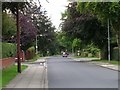
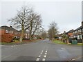
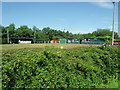
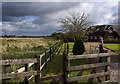
13 photos from this area
Area Information
Key information about the WN7 3NG including its size, population, and administrative classification.
- Area Type
- Postcode
- Area Size
- 1.3 hectares
- Population
- 1484
- Population Density
- 1097 people/km²
House Prices in WN7 3NG
31
Properties
£166,853
Average Sold Price
£53,000
Lowest Price
£258,000
Highest Price
Showing 31 properties
| Address | Type | Beds | Baths | Last Sale Price | Last Sale Date | |
|---|---|---|---|---|---|---|
| 8 Thames Avenue, Leigh, WN7 3NG | Semi-detached | 2 | 2 | £215,000 | Nov 2025 | |
| 12 Thames Avenue, Leigh, WN7 3NG | Bungalow | 3 | 1 | £230,000 | Oct 2023 | |
| 4 Thames Avenue, Leigh, WN7 3NG | Semi-detached | 3 | 1 | £194,000 | Jun 2023 | |
| 39 Thames Avenue, Leigh, WN7 3NG | Semi-detached | 3 | 1 | £236,750 | Aug 2020 | |
| 16 Thames Avenue, Leigh, WN7 3NG | Bungalow | 2 | - | £175,000 | Feb 2020 | |
| 41 Thames Avenue, Leigh, WN7 3NG | Semi-detached | 3 | 1 | £245,000 | May 2019 | |
| 6 Thames Avenue, Leigh, WN7 3NG | Bungalow | - | - | £258,000 | May 2019 | |
| 13 Thames Avenue, Leigh, WN7 3NG | Semi-detached | 2 | - | £187,500 | Apr 2019 | |
| 11 Thames Avenue, Leigh, WN7 3NG | Semi-detached | 4 | 1 | £167,000 | Nov 2018 | |
| 10 Thames Avenue, Leigh, WN7 3NG | Semi-detached | 3 | 1 | £165,000 | Sep 2017 |
Page 1 of 4
Energy Efficiency in WN7 3NG
Amenities
Schools
| Rank | School | Type | Entry gender | Ages |
|---|
Explore more schools in this area
Go to Schools tabDemographics
Household Size
Two person
most common
Accommodation Type
Houses
most common
Tenure
92
majority
Ethnic Group
White
most common
Religion
N/A
most common
Household Composition
N/A
most common
Age
47
median
Adults (30-64 years)
most common
Household Deprivation
N/A
with no deprivation
NS-SEC
45
in Lower managerial occupations
Explore more demographic insights in this area
Go to Demographics tabPlanning
Planning Constraints
- Flood RiskPremium
- Ramsar Wetland SitesPremium
- Area of Outstanding Natural BeautyPremium
- Protected Nature ReservePremium
- Protected WoodlandPremium