Area Overview for WN7 3NF
Photos of WN7 3NF
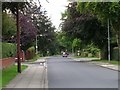
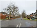
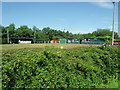
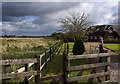
13 photos from this area
Area Information
Key information about the WN7 3NF including its size, population, and administrative classification.
- Area Type
- Postcode
- Area Size
- 5.9 hectares
- Population
- 1484
- Population Density
- 1097 people/km²
House Prices in WN7 3NF
49
Properties
£184,178
Average Sold Price
£73,500
Lowest Price
£410,000
Highest Price
Showing 49 properties
| Address | Type | Beds | Baths | Last Sale Price | Last Sale Date | |
|---|---|---|---|---|---|---|
| 18 Moreton Drive, Leigh, WN7 3NF | Bungalow | 2 | 2 | £310,000 | Nov 2025 | |
| 5 Moreton Drive, Leigh, WN7 3NF | Detached | 4 | 2 | £320,000 | Mar 2025 | |
| 17 Moreton Drive, Leigh, WN7 3NF | Detached | 4 | 3 | £410,000 | Mar 2023 | |
| 36 Moreton Drive, Leigh, WN7 3NF | Retail | 4 | 2 | £385,000 | Jul 2022 | |
| 35 Moreton Drive, Leigh, WN7 3NF | house | - | - | £360,000 | Aug 2020 | |
| 34 Moreton Drive, Leigh, WN7 3NF | Detached | 3 | - | £190,000 | May 2018 | |
| 37 Moreton Drive, Leigh, WN7 3NF | Detached | 3 | 3 | £199,950 | Sep 2017 | |
| 28 Moreton Drive, Leigh, WN7 3NF | Detached | 4 | 1 | £195,000 | Nov 2015 | |
| 30 Moreton Drive, Leigh, WN7 3NF | Detached | 4 | - | £235,000 | Oct 2014 | |
| 47 Moreton Drive, Leigh, WN7 3NF | Detached | 4 | 2 | £195,000 | Jul 2013 |
Page 1 of 5
Energy Efficiency in WN7 3NF
Amenities
Schools
| Rank | School | Type | Entry gender | Ages |
|---|
Explore more schools in this area
Go to Schools tabDemographics
Household Size
Two person
most common
Accommodation Type
Houses
most common
Tenure
92
majority
Ethnic Group
White
most common
Religion
N/A
most common
Household Composition
N/A
most common
Age
47
median
Adults (30-64 years)
most common
Household Deprivation
N/A
with no deprivation
NS-SEC
45
in Lower managerial occupations
Explore more demographic insights in this area
Go to Demographics tabPlanning
Planning Constraints
- Flood RiskPremium
- Ramsar Wetland SitesPremium
- Area of Outstanding Natural BeautyPremium
- Protected Nature ReservePremium
- Protected WoodlandPremium