Area Overview for WN7 2XN
Photos of WN7 2XN
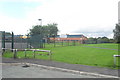
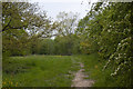
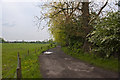
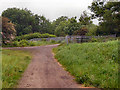
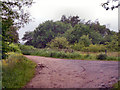
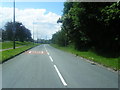
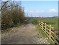
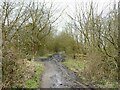
15 photos from this area
Area Information
Key information about the WN7 2XN including its size, population, and administrative classification.
- Area Type
- Postcode
- Area Size
- 8265 m²
- Population
- 2280
- Population Density
- 2067 people/km²
House Prices in WN7 2XN
21
Properties
£84,929
Average Sold Price
£57,000
Lowest Price
£120,000
Highest Price
Showing 21 properties
| Address | Type | Beds | Baths | Last Sale Price | Last Sale Date | |
|---|---|---|---|---|---|---|
| 102 Chatsworth Drive, Leigh, WN7 2XN | Semi-detached | 2 | 1 | £120,000 | Sep 2024 | |
| 83 Chatsworth Drive, Leigh, WN7 2XN | house | 2 | - | £110,000 | May 2022 | |
| 97 Chatsworth Drive, Leigh, WN7 2XN | Semi-detached | 2 | 1 | £100,000 | Sep 2021 | |
| 103 Chatsworth Drive, Leigh, WN7 2XN | Terraced | 2 | 1 | £67,500 | Apr 2015 | |
| 89 Chatsworth Drive, Leigh, WN7 2XN | Terraced | 2 | - | £80,000 | Jul 2013 | |
| 81 Chatsworth Drive, Leigh, WN7 2XN | Semi-detached | - | - | £57,000 | May 2006 | |
| 108 Chatsworth Drive, Leigh, WN7 2XN | Semi-detached | - | - | £60,000 | Nov 2005 | |
| 91 Chatsworth Drive, Leigh, WN7 2XN | Semi-detached | - | - | - | - | |
| 99 Chatsworth Drive, Leigh, WN7 2XN | house | - | - | - | - | |
| 100 Chatsworth Drive, Leigh, WN7 2XN | Semi-detached | - | - | - | - |
Page 1 of 3
Energy Efficiency in WN7 2XN
Amenities
Schools
| Rank | School | Type | Entry gender | Ages |
|---|
Explore more schools in this area
Go to Schools tabDemographics
Household Size
One person
most common
Accommodation Type
Houses
most common
Tenure
45
majority
Ethnic Group
White
most common
Religion
N/A
most common
Household Composition
N/A
most common
Age
47
median
Adults (30-64 years)
most common
Household Deprivation
N/A
with no deprivation
NS-SEC
21
in Lower managerial occupations
Explore more demographic insights in this area
Go to Demographics tabPlanning
Planning Constraints
- Flood RiskPremium
- Ramsar Wetland SitesPremium
- Area of Outstanding Natural BeautyPremium
- Protected Nature ReservePremium
- Protected WoodlandPremium