Area Overview for WN7 2BS
Photos of WN7 2BS
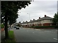
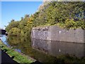
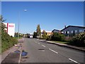

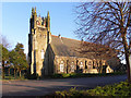

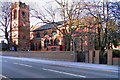
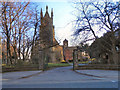
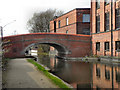
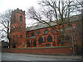

67 photos from this area
Area Information
Key information about the WN7 2BS including its size, population, and administrative classification.
- Area Type
- Postcode
- Area Size
- 6674 m²
- Population
- 1578
- Population Density
- 8394 people/km²
House Prices in WN7 2BS
54
Properties
£73,797
Average Sold Price
£19,000
Lowest Price
£141,000
Highest Price
Showing 54 properties
| Address | Type | Beds | Baths | Last Sale Price | Last Sale Date | |
|---|---|---|---|---|---|---|
| 16 Clifford Street, Leigh, WN7 2BS | Terraced | 2 | 1 | £122,500 | Jul 2025 | |
| 24 Clifford Street, Leigh, WN7 2BS | Terraced | 3 | 2 | £77,500 | Apr 2024 | |
| 45 Clifford Street, Leigh, WN7 2BS | Terraced | 2 | 1 | £110,000 | Feb 2024 | |
| 34 Clifford Street, Leigh, WN7 2BS | Terraced | 2 | 1 | £133,000 | Jan 2024 | |
| 40 Clifford Street, Leigh, WN7 2BS | Terraced | 3 | 1 | £108,000 | Aug 2023 | |
| 15 Clifford Street, Leigh, WN7 2BS | Terraced | 3 | 1 | £114,000 | Jul 2023 | |
| 41 Clifford Street, Leigh, WN7 2BS | Terraced | 2 | 1 | £135,000 | Mar 2023 | |
| 48 Clifford Street, Leigh, WN7 2BS | Terraced | 2 | 1 | £141,000 | May 2022 | |
| 5 Clifford Street, Leigh, WN7 2BS | Terraced | 3 | 1 | £95,000 | Apr 2022 | |
| 35 Clifford Street, Leigh, WN7 2BS | house | - | - | £75,000 | Nov 2020 |
Page 1 of 6
Energy Efficiency in WN7 2BS
Amenities
Schools
| Rank | School | Type | Entry gender | Ages |
|---|
Explore more schools in this area
Go to Schools tabDemographics
Household Size
One person
most common
Accommodation Type
Houses
most common
Tenure
54
majority
Ethnic Group
White
most common
Religion
N/A
most common
Household Composition
N/A
most common
Age
47
median
Adults (30-64 years)
most common
Household Deprivation
N/A
with no deprivation
NS-SEC
22
in Lower managerial occupations
Explore more demographic insights in this area
Go to Demographics tabPlanning
Planning Constraints
- Flood RiskPremium
- Ramsar Wetland SitesPremium
- Area of Outstanding Natural BeautyPremium
- Protected Nature ReservePremium
- Protected WoodlandPremium