Area Overview for WN7 2BE
Photos of WN7 2BE
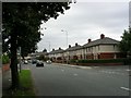
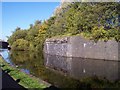
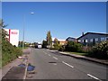
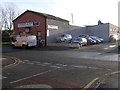


67 photos from this area
Area Information
Key information about the WN7 2BE including its size, population, and administrative classification.
- Area Type
- Postcode
- Area Size
- 1.5 hectares
- Population
- 1399
- Population Density
- 5525 people/km²
House Prices in WN7 2BE
50
Properties
£107,873
Average Sold Price
£27,000
Lowest Price
£196,500
Highest Price
Showing 50 properties
| Address | Type | Beds | Baths | Last Sale Price | Last Sale Date | |
|---|---|---|---|---|---|---|
| 84 Edale Road, Leigh, WN7 2BE | Terraced | 2 | 1 | £122,500 | Jul 2023 | |
| 72 Edale Road, Leigh, WN7 2BE | Terraced | 3 | 1 | £170,000 | May 2022 | |
| 71 Edale Road, Leigh, WN7 2BE | Semi-detached | 3 | 1 | £165,000 | Apr 2022 | |
| 55 Edale Road, Leigh, WN7 2BE | house | - | - | £149,000 | Mar 2022 | |
| 42 Edale Road, Leigh, WN7 2BE | Semi-detached | 3 | 1 | £137,500 | Dec 2018 | |
| 82 Edale Road, Leigh, WN7 2BE | Terraced | 2 | 1 | £96,500 | Oct 2018 | |
| 61 Edale Road, Leigh, WN7 2BE | Bungalow | - | - | £175,000 | Apr 2018 | |
| 38 Edale Road, Leigh, WN7 2BE | Semi-detached | 3 | 1 | £123,000 | Sep 2017 | |
| 68 Edale Road, Leigh, WN7 2BE | house | 3 | 2 | £119,000 | Jun 2017 | |
| 53 Edale Road, Leigh, WN7 2BE | Semi-detached | 4 | 1 | £137,000 | Feb 2017 |
Page 1 of 5
Energy Efficiency in WN7 2BE
Amenities
Schools
| Rank | School | Type | Entry gender | Ages |
|---|
Explore more schools in this area
Go to Schools tabDemographics
Household Size
Two person
most common
Accommodation Type
Houses
most common
Tenure
85
majority
Ethnic Group
White
most common
Religion
N/A
most common
Household Composition
N/A
most common
Age
47
median
Adults (30-64 years)
most common
Household Deprivation
N/A
with no deprivation
NS-SEC
31
in Lower managerial occupations
Explore more demographic insights in this area
Go to Demographics tabPlanning
Planning Constraints
- Flood RiskPremium
- Ramsar Wetland SitesPremium
- Area of Outstanding Natural BeautyPremium
- Protected Nature ReservePremium
- Protected WoodlandPremium