Area Overview for WN6 0TU
Photos of WN6 0TU
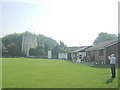
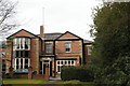
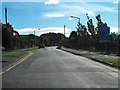
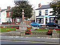
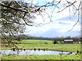
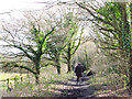
24 photos from this area
Area Information
Key information about the WN6 0TU including its size, population, and administrative classification.
- Area Type
- Postcode
- Area Size
- 1.5 hectares
- Population
- 1379
- Population Density
- 530 people/km²
House Prices in WN6 0TU
36
Properties
£186,691
Average Sold Price
£93,000
Lowest Price
£380,000
Highest Price
Showing 36 properties
| Address | Type | Beds | Baths | Last Sale Price | Last Sale Date | |
|---|---|---|---|---|---|---|
| 16, Prospect House, Green Lane, Standish, WN6 0TU | Flat | - | - | £190,000 | Jan 2025 | |
| 4, Prospect House, Green Lane, Standish, WN6 0TU | Flat | 2 | 1 | £142,000 | Jul 2023 | |
| 1, Prospect House, Green Lane, Standish, WN6 0TU | Flat | 2 | 2 | £138,000 | Sep 2022 | |
| 67 Green Lane, Standish, WN6 0TU | Bungalow | - | - | £270,000 | Aug 2021 | |
| 77 Green Lane, Standish, WN6 0TU | house | - | - | £380,000 | Apr 2021 | |
| 83 Green Lane, Standish, WN6 0TU | Land | - | - | £325,000 | Jun 2020 | |
| 6, Prospect House, Green Lane, Standish, WN6 0TU | Flat | - | - | £110,500 | Sep 2019 | |
| 10, Prospect House, Green Lane, Standish, WN6 0TU | Flat | - | - | £149,000 | Oct 2018 | |
| 55 Green Lane, Standish, WN6 0TU | house | 4 | - | £285,000 | May 2018 | |
| 9, Prospect House, Green Lane, Standish, WN6 0TU | Flat | - | - | £136,000 | Aug 2015 |
Page 1 of 4
Energy Efficiency in WN6 0TU
Amenities
Schools
| Rank | School | Type | Entry gender | Ages |
|---|
Explore more schools in this area
Go to Schools tabDemographics
Household Size
Two person
most common
Accommodation Type
Houses
most common
Tenure
82
majority
Ethnic Group
White
most common
Religion
N/A
most common
Household Composition
N/A
most common
Age
47
median
Adults (30-64 years)
most common
Household Deprivation
N/A
with no deprivation
NS-SEC
41
in Lower managerial occupations
Explore more demographic insights in this area
Go to Demographics tabPlanning
Planning Constraints
- Flood RiskPremium
- Ramsar Wetland SitesPremium
- Area of Outstanding Natural BeautyPremium
- Protected Nature ReservePremium
- Protected WoodlandPremium