Area Overview for WN5 9DP
Photos of WN5 9DP

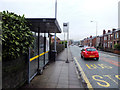
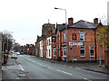
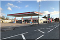
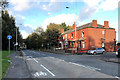
32 photos from this area
Area Information
Key information about the WN5 9DP including its size, population, and administrative classification.
- Area Type
- Postcode
- Area Size
- 9392 m²
- Population
- 2034
- Population Density
- 3613 people/km²
House Prices in WN5 9DP
40
Properties
£95,998
Average Sold Price
£13,000
Lowest Price
£220,000
Highest Price
Showing 40 properties
| Address | Type | Beds | Baths | Last Sale Price | Last Sale Date | |
|---|---|---|---|---|---|---|
| 193 Ormskirk Road, Wigan, WN5 9DP | house | 4 | 2 | £119,501 | Oct 2024 | |
| 159 Ormskirk Road, Wigan, WN5 9DP | Terraced | 3 | 1 | £133,000 | May 2024 | |
| 143 Ormskirk Road, Wigan, WN5 9DP | Terraced | 2 | 1 | £85,000 | May 2024 | |
| 213 Ormskirk Road, Wigan, WN5 9DP | house | - | - | £220,000 | Apr 2024 | |
| 177 Ormskirk Road, Wigan, WN5 9DP | house | - | - | £130,000 | Mar 2023 | |
| 171 Ormskirk Road, Wigan, WN5 9DP | Terraced | 2 | 1 | £98,000 | Feb 2023 | |
| 169 Ormskirk Road, Wigan, WN5 9DP | house | - | - | £140,000 | Sep 2022 | |
| 141 Ormskirk Road, Wigan, WN5 9DP | house | - | - | £90,000 | May 2021 | |
| 139 Ormskirk Road, Wigan, WN5 9DP | Semi-detached | 4 | 1 | £96,000 | Apr 2021 | |
| 153 Ormskirk Road, Wigan, WN5 9DP | Terraced | 2 | 1 | £74,000 | Feb 2021 |
Page 1 of 4
Energy Efficiency in WN5 9DP
Amenities
Schools
| Rank | School | Type | Entry gender | Ages |
|---|
Explore more schools in this area
Go to Schools tabDemographics
Household Size
Two person
most common
Accommodation Type
Houses
most common
Tenure
58
majority
Ethnic Group
White
most common
Religion
N/A
most common
Household Composition
N/A
most common
Age
47
median
Adults (30-64 years)
most common
Household Deprivation
N/A
with no deprivation
NS-SEC
22
in Lower managerial occupations
Explore more demographic insights in this area
Go to Demographics tabPlanning
Planning Constraints
- Flood RiskPremium
- Ramsar Wetland SitesPremium
- Area of Outstanding Natural BeautyPremium
- Protected Nature ReservePremium
- Protected WoodlandPremium