Area Overview for WN5 7TH
Photos of WN5 7TH

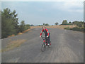
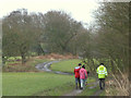
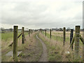
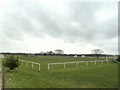
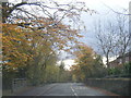
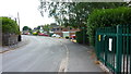
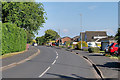

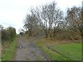

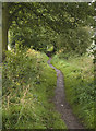
23 photos from this area
Area Information
Key information about the WN5 7TH including its size, population, and administrative classification.
- Area Type
- Postcode
- Area Size
- 15.1 hectares
- Population
- 1411
- Population Density
- 2214 people/km²
House Prices in WN5 7TH
43
Properties
£253,276
Average Sold Price
£58,500
Lowest Price
£740,000
Highest Price
Showing 43 properties
| Address | Type | Beds | Baths | Last Sale Price | Last Sale Date | |
|---|---|---|---|---|---|---|
| 7 Garswood Road, Billinge, St Helens, WN5 7TH | Detached | 3 | 2 | £282,500 | Aug 2025 | |
| 53 Garswood Road, Billinge, St Helens, WN5 7TH | Bungalow | 3 | 1 | £430,000 | Dec 2024 | |
| 14 Garswood Road, Billinge, St Helens, WN5 7TH | Terraced | 2 | 1 | £178,000 | Sep 2024 | |
| 28 Garswood Road, Billinge, St Helens, WN5 7TH | Detached | 4 | 1 | £415,000 | Aug 2024 | |
| 52 Garswood Road, Billinge, St Helens, WN5 7TH | Detached | 5 | 2 | £507,500 | Feb 2024 | |
| 43 Garswood Road, Billinge, St Helens, WN5 7TH | Detached | 5 | 3 | £740,000 | Aug 2023 | |
| 3 Garswood Road, Billinge, St Helens, WN5 7TH | Retail | 2 | 1 | £216,500 | Sep 2022 | |
| 18 Garswood Road, Billinge, St Helens, WN5 7TH | Terraced | 2 | 1 | £123,500 | Aug 2019 | |
| 39 Garswood Road, Billinge, St Helens, WN5 7TH | house | - | - | £440,000 | Jun 2019 | |
| 4 Garswood Road, Billinge, St Helens, WN5 7TH | Semi-detached | 2 | 1 | £115,000 | Feb 2019 |
Page 1 of 5
Energy Efficiency in WN5 7TH
Amenities
Schools
| Rank | School | Type | Entry gender | Ages |
|---|
Explore more schools in this area
Go to Schools tabDemographics
Household Size
Two person
most common
Accommodation Type
Houses
most common
Tenure
93
majority
Ethnic Group
White
most common
Religion
N/A
most common
Household Composition
N/A
most common
Age
47
median
Adults (30-64 years)
most common
Household Deprivation
N/A
with no deprivation
NS-SEC
40
in Lower managerial occupations
Explore more demographic insights in this area
Go to Demographics tabPlanning
Planning Constraints
- Flood RiskPremium
- Ramsar Wetland SitesPremium
- Area of Outstanding Natural BeautyPremium
- Protected Nature ReservePremium
- Protected WoodlandPremium