Area Overview for WN5 7BN
Photos of WN5 7BN

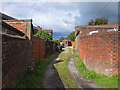
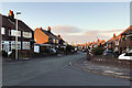
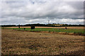
38 photos from this area
Area Information
Key information about the WN5 7BN including its size, population, and administrative classification.
- Area Type
- Postcode
- Area Size
- 8130 m²
- Population
- 1850
- Population Density
- 1397 people/km²
House Prices in WN5 7BN
26
Properties
£118,964
Average Sold Price
£20,640
Lowest Price
£207,000
Highest Price
Showing 26 properties
| Address | Type | Beds | Baths | Last Sale Price | Last Sale Date | |
|---|---|---|---|---|---|---|
| 22 The Avenue, Billinge, WN5 7BN | Semi-detached | 2 | 1 | £196,000 | May 2024 | |
| 14 The Avenue, Billinge, WN5 7BN | Semi-detached | 3 | 1 | £207,000 | Jun 2022 | |
| 4 The Avenue, Billinge, WN5 7BN | Semi-detached | 4 | - | £185,000 | Nov 2020 | |
| 12 The Avenue, Billinge, WN5 7BN | Semi-detached | 2 | 1 | £160,000 | Aug 2020 | |
| 23 The Avenue, Billinge, WN5 7BN | Semi-detached | 3 | 1 | £128,000 | May 2018 | |
| 1 The Avenue, Billinge, WN5 7BN | house | - | - | £85,000 | Apr 2011 | |
| 19 The Avenue, Billinge, WN5 7BN | Semi-detached | - | - | £124,000 | Jul 2008 | |
| 2 The Avenue, Billinge, WN5 7BN | Semi-detached | - | - | £45,000 | Apr 2004 | |
| 18 The Avenue, Billinge, WN5 7BN | Semi-detached | - | - | £39,000 | Feb 1996 | |
| 17 The Avenue, Billinge, WN5 7BN | Semi-detached | - | - | £20,640 | Apr 1995 |
Page 1 of 3
Energy Efficiency in WN5 7BN
Amenities
Schools
| Rank | School | Type | Entry gender | Ages |
|---|
Explore more schools in this area
Go to Schools tabDemographics
Household Size
One person
most common
Accommodation Type
Houses
most common
Tenure
70
majority
Ethnic Group
White
most common
Religion
N/A
most common
Household Composition
N/A
most common
Age
47
median
Adults (30-64 years)
most common
Household Deprivation
N/A
with no deprivation
NS-SEC
36
in Lower managerial occupations
Explore more demographic insights in this area
Go to Demographics tabPlanning
Planning Constraints
- Flood RiskPremium
- Ramsar Wetland SitesPremium
- Area of Outstanding Natural BeautyPremium
- Protected Nature ReservePremium
- Protected WoodlandPremium