Area Overview for WN5 7AF
Photos of WN5 7AF
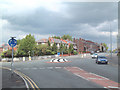
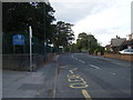
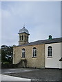

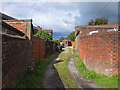
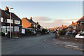
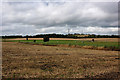
38 photos from this area
Area Information
Key information about the WN5 7AF including its size, population, and administrative classification.
- Area Type
- Postcode
- Area Size
- 1.4 hectares
- Population
- 1850
- Population Density
- 1397 people/km²
House Prices in WN5 7AF
67
Properties
£100,707
Average Sold Price
£47,950
Lowest Price
£185,000
Highest Price
Showing 67 properties
| Address | Type | Beds | Baths | Last Sale Price | Last Sale Date | |
|---|---|---|---|---|---|---|
| 59 Gantley Avenue, Billinge, WN5 7AF | Flat | 2 | 1 | £88,000 | Mar 2025 | |
| 25 Gantley Avenue, Billinge, WN5 7AF | Flat | - | - | £60,000 | Jun 2024 | |
| 64 Gantley Avenue, Billinge, WN5 7AF | Flat | - | - | £82,000 | Feb 2024 | |
| 7 Gantley Avenue, Billinge, WN5 7AF | Semi-detached | 3 | 1 | £160,000 | Dec 2021 | |
| 1 Gantley Avenue, Billinge, WN5 7AF | Semi-detached | 4 | 2 | £185,000 | Jul 2017 | |
| 52 Gantley Avenue, Billinge, WN5 7AF | Flat | - | - | £82,000 | Jun 2008 | |
| 3 Gantley Avenue, Billinge, WN5 7AF | Semi-detached | - | - | £47,950 | Jun 1999 | |
| 33 Gantley Avenue, Billinge, WN5 7AF | Flat | 3 | 1 | - | - | |
| 35 Gantley Avenue, Billinge, WN5 7AF | Flat | 2 | 1 | - | - | |
| Wigan And Leigh Housing, Gantley Court, Gantley Avenue, Billinge, WN5 7AF | commercial | - | - | - | - |
Page 1 of 7
Energy Efficiency in WN5 7AF
Amenities
Schools
| Rank | School | Type | Entry gender | Ages |
|---|
Explore more schools in this area
Go to Schools tabDemographics
Household Size
One person
most common
Accommodation Type
Houses
most common
Tenure
70
majority
Ethnic Group
White
most common
Religion
N/A
most common
Household Composition
N/A
most common
Age
47
median
Adults (30-64 years)
most common
Household Deprivation
N/A
with no deprivation
NS-SEC
36
in Lower managerial occupations
Explore more demographic insights in this area
Go to Demographics tabPlanning
Planning Constraints
- Flood RiskPremium
- Ramsar Wetland SitesPremium
- Area of Outstanding Natural BeautyPremium
- Protected Nature ReservePremium
- Protected WoodlandPremium