Area Overview for WN4 9RX
Photos of WN4 9RX
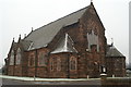


21 photos from this area
Area Information
Key information about the WN4 9RX including its size, population, and administrative classification.
- Area Type
- Postcode
- Area Size
- 2.8 hectares
- Population
- 1373
- Population Density
- 3355 people/km²
House Prices in WN4 9RX
35
Properties
£127,762
Average Sold Price
£44,000
Lowest Price
£305,000
Highest Price
Showing 35 properties
| Address | Type | Beds | Baths | Last Sale Price | Last Sale Date | |
|---|---|---|---|---|---|---|
| 54 Bispham Drive, Ashton In Makerfield, WN4 9RX | house | - | - | £305,000 | Aug 2024 | |
| 10 Bispham Drive, Ashton In Makerfield, WN4 9RX | Semi-detached | 2 | 1 | £151,000 | Mar 2024 | |
| 13 Bispham Drive, Ashton In Makerfield, WN4 9RX | Bungalow | 2 | 1 | £162,000 | Feb 2024 | |
| 16 Bispham Drive, Ashton In Makerfield, WN4 9RX | house | - | - | £136,500 | May 2021 | |
| 24 Bispham Drive, Ashton In Makerfield, WN4 9RX | Semi-detached | 3 | - | £124,500 | Dec 2019 | |
| 44 Bispham Drive, Ashton In Makerfield, WN4 9RX | Bungalow | - | - | £178,000 | Aug 2019 | |
| 20 Bispham Drive, Ashton In Makerfield, WN4 9RX | Semi-detached | 4 | 1 | £140,000 | Jun 2016 | |
| 12 Bispham Drive, Ashton In Makerfield, WN4 9RX | house | - | - | £116,000 | Jul 2015 | |
| 15 Bispham Drive, Ashton In Makerfield, WN4 9RX | Bungalow | - | - | £110,000 | Jan 2010 | |
| 48 Bispham Drive, Ashton In Makerfield, WN4 9RX | Semi-detached | - | - | £182,500 | May 2007 |
Page 1 of 4
Energy Efficiency in WN4 9RX
Amenities
Schools
| Rank | School | Type | Entry gender | Ages |
|---|
Explore more schools in this area
Go to Schools tabDemographics
Household Size
Two person
most common
Accommodation Type
Houses
most common
Tenure
90
majority
Ethnic Group
White
most common
Religion
N/A
most common
Household Composition
N/A
most common
Age
47
median
Adults (30-64 years)
most common
Household Deprivation
N/A
with no deprivation
NS-SEC
26
in Lower managerial occupations
Explore more demographic insights in this area
Go to Demographics tabPlanning
Planning Constraints
- Flood RiskPremium
- Ramsar Wetland SitesPremium
- Area of Outstanding Natural BeautyPremium
- Protected Nature ReservePremium
- Protected WoodlandPremium