Area Overview for WN4 9JN
Photos of WN4 9JN
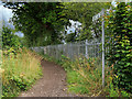
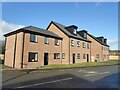
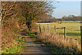
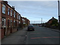
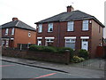

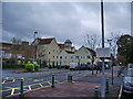
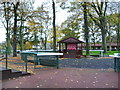
20 photos from this area
Area Information
Key information about the WN4 9JN including its size, population, and administrative classification.
- Area Type
- Postcode
- Area Size
- 1.3 hectares
- Population
- 1714
- Population Density
- 2954 people/km²
House Prices in WN4 9JN
36
Properties
£115,371
Average Sold Price
£27,000
Lowest Price
£200,000
Highest Price
Showing 36 properties
| Address | Type | Beds | Baths | Last Sale Price | Last Sale Date | |
|---|---|---|---|---|---|---|
| 30 Blenheim Road, Ashton In Makerfield, WN4 9JN | Semi-detached | 3 | 1 | £190,000 | Aug 2022 | |
| 16 Blenheim Road, Ashton In Makerfield, WN4 9JN | house | - | - | £175,000 | Apr 2022 | |
| 50 Blenheim Road, Ashton In Makerfield, WN4 9JN | Detached | 3 | 1 | £155,200 | Sep 2018 | |
| 18A Blenheim Road, Ashton In Makerfield, WN4 9JN | Bungalow | 3 | 1 | £200,000 | Aug 2017 | |
| 38 Blenheim Road, Ashton In Makerfield, WN4 9JN | house | - | - | £133,000 | Jan 2017 | |
| 36 Blenheim Road, Ashton In Makerfield, WN4 9JN | Semi-detached | - | - | £37,000 | Feb 2015 | |
| 40 Blenheim Road, Ashton In Makerfield, WN4 9JN | Semi-detached | 3 | 1 | £140,000 | Oct 2010 | |
| 62 Blenheim Road, Ashton In Makerfield, WN4 9JN | house | 3 | 1 | £102,000 | Jun 2009 | |
| 56 Blenheim Road, Ashton In Makerfield, WN4 9JN | Semi-detached | - | - | £131,000 | Apr 2007 | |
| 18 Blenheim Road, Ashton In Makerfield, WN4 9JN | house | - | - | £147,500 | Sep 2006 |
Page 1 of 4
Energy Efficiency in WN4 9JN
Amenities
Schools
| Rank | School | Type | Entry gender | Ages |
|---|
Explore more schools in this area
Go to Schools tabDemographics
Household Size
Two person
most common
Accommodation Type
Houses
most common
Tenure
80
majority
Ethnic Group
White
most common
Religion
N/A
most common
Household Composition
N/A
most common
Age
47
median
Adults (30-64 years)
most common
Household Deprivation
N/A
with no deprivation
NS-SEC
29
in Lower managerial occupations
Explore more demographic insights in this area
Go to Demographics tabPlanning
Planning Constraints
- Flood RiskPremium
- Ramsar Wetland SitesPremium
- Area of Outstanding Natural BeautyPremium
- Protected Nature ReservePremium
- Protected WoodlandPremium