Area Overview for WN4 9HP
Photos of WN4 9HP
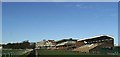
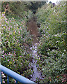
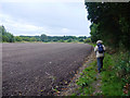
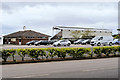
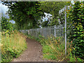
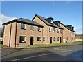
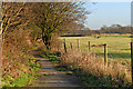
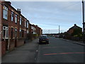
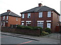

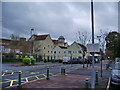
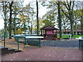
20 photos from this area
Area Information
Key information about the WN4 9HP including its size, population, and administrative classification.
- Area Type
- Postcode
- Area Size
- 7808 m²
- Population
- 1714
- Population Density
- 2954 people/km²
House Prices in WN4 9HP
31
Properties
£108,263
Average Sold Price
£11,500
Lowest Price
£280,000
Highest Price
Showing 31 properties
| Address | Type | Beds | Baths | Last Sale Price | Last Sale Date | |
|---|---|---|---|---|---|---|
| 3 Mill Street, Ashton In Makerfield, WN4 9HP | Detached | 4 | 1 | £220,000 | Feb 2025 | |
| 8 Mill Street, Ashton In Makerfield, WN4 9HP | house | 2 | 1 | £84,650 | Nov 2024 | |
| 7 Mill Street, Ashton In Makerfield, WN4 9HP | Terraced | 3 | 1 | £175,000 | Aug 2024 | |
| 15A Mill Street, Ashton In Makerfield, WN4 9HP | Flat | - | - | £58,000 | Mar 2024 | |
| 4 Mill Street, Ashton In Makerfield, WN4 9HP | Terraced | 2 | 1 | £70,000 | Mar 2021 | |
| 6 Mill Street, Ashton In Makerfield, WN4 9HP | house | 2 | - | £80,000 | Dec 2018 | |
| 32 Mill Street, Ashton In Makerfield, WN4 9HP | Semi-detached | - | - | £95,000 | Mar 2018 | |
| 20 Mill Street, Ashton In Makerfield, WN4 9HP | Detached | 4 | 3 | £280,000 | Nov 2016 | |
| 24 Mill Street, Ashton In Makerfield, WN4 9HP | Detached | 4 | 2 | £143,000 | Jun 2004 | |
| 11 Mill Street, Ashton In Makerfield, WN4 9HP | Terraced | - | - | £35,000 | May 2002 |
Page 1 of 4
Energy Efficiency in WN4 9HP
Amenities
Schools
| Rank | School | Type | Entry gender | Ages |
|---|
Explore more schools in this area
Go to Schools tabDemographics
Household Size
Two person
most common
Accommodation Type
Houses
most common
Tenure
80
majority
Ethnic Group
White
most common
Religion
N/A
most common
Household Composition
N/A
most common
Age
47
median
Adults (30-64 years)
most common
Household Deprivation
N/A
with no deprivation
NS-SEC
29
in Lower managerial occupations
Explore more demographic insights in this area
Go to Demographics tabPlanning
Planning Constraints
- Flood RiskPremium
- Ramsar Wetland SitesPremium
- Area of Outstanding Natural BeautyPremium
- Protected Nature ReservePremium
- Protected WoodlandPremium