Area Overview for WN4 8XA
Photos of WN4 8XA


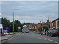


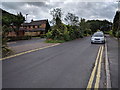

29 photos from this area
Area Information
Key information about the WN4 8XA including its size, population, and administrative classification.
- Area Type
- Postcode
- Area Size
- 2.0 hectares
- Population
- 1556
- Population Density
- 2392 people/km²
House Prices in WN4 8XA
32
Properties
£117,423
Average Sold Price
£25,000
Lowest Price
£287,500
Highest Price
Showing 32 properties
| Address | Type | Beds | Baths | Last Sale Price | Last Sale Date | |
|---|---|---|---|---|---|---|
| 70 Golborne Road, Ashton In Makerfield, WN4 8XA | Semi-detached | 3 | 1 | £126,000 | May 2021 | |
| 57 Golborne Road, Ashton In Makerfield, WN4 8XA | Semi-detached | 3 | - | £112,500 | Dec 2019 | |
| 51 Golborne Road, Ashton In Makerfield, WN4 8XA | Bungalow | 3 | - | £130,000 | Feb 2019 | |
| 73 Golborne Road, Ashton In Makerfield, WN4 8XA | Terraced | 2 | 1 | £75,000 | Jan 2019 | |
| 83 Golborne Road, Ashton In Makerfield, WN4 8XA | Bungalow | 4 | 2 | £287,500 | Jul 2018 | |
| 72 Golborne Road, Ashton In Makerfield, WN4 8XA | house | - | - | £85,000 | Jul 2018 | |
| 53 Golborne Road, Ashton In Makerfield, WN4 8XA | Semi-detached | 3 | - | £150,000 | May 2018 | |
| 76A Golborne Road, Ashton In Makerfield, WN4 8XA | Detached | 4 | 2 | £210,000 | Feb 2018 | |
| 81 Golborne Road, Ashton In Makerfield, WN4 8XA | Bungalow | - | - | £174,995 | Jul 2009 | |
| 68 Golborne Road, Ashton In Makerfield, WN4 8XA | house | - | - | £89,000 | Oct 2005 |
Page 1 of 4
Energy Efficiency in WN4 8XA
Amenities
Schools
| Rank | School | Type | Entry gender | Ages |
|---|
Explore more schools in this area
Go to Schools tabDemographics
Household Size
Two person
most common
Accommodation Type
Houses
most common
Tenure
92
majority
Ethnic Group
White
most common
Religion
N/A
most common
Household Composition
N/A
most common
Age
47
median
Adults (30-64 years)
most common
Household Deprivation
N/A
with no deprivation
NS-SEC
33
in Lower managerial occupations
Explore more demographic insights in this area
Go to Demographics tabPlanning
Planning Constraints
- Flood RiskPremium
- Ramsar Wetland SitesPremium
- Area of Outstanding Natural BeautyPremium
- Protected Nature ReservePremium
- Protected WoodlandPremium