Area Overview for WN4 8QT
Photos of WN4 8QT
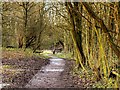
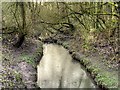
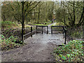

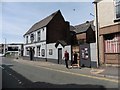
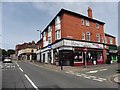

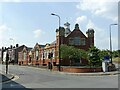
37 photos from this area
Area Information
Key information about the WN4 8QT including its size, population, and administrative classification.
- Area Type
- Postcode
- Area Size
- 8531 m²
- Population
- 1490
- Population Density
- 2738 people/km²
House Prices in WN4 8QT
24
Properties
£136,588
Average Sold Price
£2,000
Lowest Price
£280,000
Highest Price
Showing 24 properties
| Address | Type | Beds | Baths | Last Sale Price | Last Sale Date | |
|---|---|---|---|---|---|---|
| 5 Eskdale Road, Ashton In Makerfield, WN4 8QT | Semi-detached | 3 | 2 | £280,000 | Jul 2024 | |
| 20 Eskdale Road, Ashton In Makerfield, WN4 8QT | Semi-detached | - | - | £2,000 | Jan 2019 | |
| 25 Eskdale Road, Ashton In Makerfield, WN4 8QT | Detached | 4 | 1 | £233,500 | Nov 2018 | |
| 26 Eskdale Road, Ashton In Makerfield, WN4 8QT | house | - | - | £180,750 | Aug 2016 | |
| 22 Eskdale Road, Ashton In Makerfield, WN4 8QT | house | - | - | £172,000 | Aug 2012 | |
| 23 Eskdale Road, Ashton In Makerfield, WN4 8QT | Semi-detached | - | - | £105,000 | Sep 2006 | |
| 12 Eskdale Road, Ashton In Makerfield, WN4 8QT | Semi-detached | - | - | £69,500 | Nov 1997 | |
| 9 Eskdale Road, Ashton In Makerfield, WN4 8QT | Semi-detached | - | - | £49,950 | Aug 1996 | |
| 4 Eskdale Road, Ashton In Makerfield, WN4 8QT | Semi-detached | 3 | 2 | - | - | |
| 19 Eskdale Road, Ashton In Makerfield, WN4 8QT | Semi-detached | - | - | - | - |
Page 1 of 3
Energy Efficiency in WN4 8QT
Amenities
Schools
| Rank | School | Type | Entry gender | Ages |
|---|
Explore more schools in this area
Go to Schools tabDemographics
Household Size
Two person
most common
Accommodation Type
Houses
most common
Tenure
94
majority
Ethnic Group
White
most common
Religion
N/A
most common
Household Composition
N/A
most common
Age
47
median
Adults (30-64 years)
most common
Household Deprivation
N/A
with no deprivation
NS-SEC
35
in Lower managerial occupations
Explore more demographic insights in this area
Go to Demographics tabPlanning
Planning Constraints
- Flood RiskPremium
- Ramsar Wetland SitesPremium
- Area of Outstanding Natural BeautyPremium
- Protected Nature ReservePremium
- Protected WoodlandPremium