Area Overview for WN4 0XH
Photos of WN4 0XH
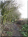
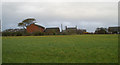
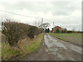
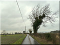
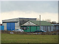
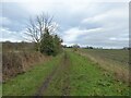
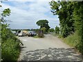
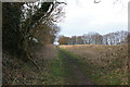
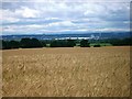
21 photos from this area
Area Information
Key information about the WN4 0XH including its size, population, and administrative classification.
- Area Type
- Postcode
- Area Size
- 25.1 hectares
- Population
- 1399
- Population Density
- 174 people/km²
House Prices in WN4 0XH
42
Properties
£107,033
Average Sold Price
£5,000
Lowest Price
£390,000
Highest Price
Showing 42 properties
| Address | Type | Beds | Baths | Last Sale Price | Last Sale Date | |
|---|---|---|---|---|---|---|
| 508 Garswood Road, Ashton In Makerfield, St Helens, WN4 0XH | house | 4 | 2 | £390,000 | Mar 2025 | |
| 520 Garswood Road, Ashton In Makerfield, St Helens, WN4 0XH | house | - | - | £120,000 | Jul 2023 | |
| 565 Garswood Road, Ashton In Makerfield, St Helens, WN4 0XH | Terraced | 2 | 2 | £100,000 | Apr 2022 | |
| 518 Garswood Road, Ashton In Makerfield, St Helens, WN4 0XH | Retail | 3 | 1 | £150,000 | Mar 2022 | |
| 500 Garswood Road, Ashton In Makerfield, St Helens, WN4 0XH | Semi-detached | 2 | 1 | £210,000 | Feb 2022 | |
| 524 Garswood Road, Ashton In Makerfield, St Helens, WN4 0XH | Bungalow | - | - | £175,000 | Aug 2021 | |
| 522 Garswood Road, Ashton In Makerfield, St Helens, WN4 0XH | house | - | - | £172,500 | Dec 2020 | |
| 589 Garswood Road, Ashton In Makerfield, St Helens, WN4 0XH | Terraced | 2 | 1 | £122,000 | Sep 2020 | |
| 506 Garswood Road, Ashton In Makerfield, St Helens, WN4 0XH | house | - | - | £115,000 | Jun 2019 | |
| 551 Garswood Road, Ashton In Makerfield, St Helens, WN4 0XH | Terraced | 2 | - | £117,000 | Oct 2016 |
Page 1 of 5
Energy Efficiency in WN4 0XH
Amenities
Schools
| Rank | School | Type | Entry gender | Ages |
|---|
Explore more schools in this area
Go to Schools tabDemographics
Household Size
Two person
most common
Accommodation Type
Houses
most common
Tenure
92
majority
Ethnic Group
White
most common
Religion
N/A
most common
Household Composition
N/A
most common
Age
47
median
Adults (30-64 years)
most common
Household Deprivation
N/A
with no deprivation
NS-SEC
39
in Lower managerial occupations
Explore more demographic insights in this area
Go to Demographics tabPlanning
Planning Constraints
- Flood RiskPremium
- Ramsar Wetland SitesPremium
- Area of Outstanding Natural BeautyPremium
- Protected Nature ReservePremium
- Protected WoodlandPremium