Area Overview for WN4 0SU
Photos of WN4 0SU

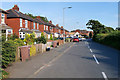
43 photos from this area
Area Information
Key information about the WN4 0SU including its size, population, and administrative classification.
- Area Type
- Postcode
- Area Size
- 2.0 hectares
- Population
- 1183
- Population Density
- 6440 people/km²
House Prices in WN4 0SU
56
Properties
£135,205
Average Sold Price
£900
Lowest Price
£220,000
Highest Price
Showing 56 properties
| Address | Type | Beds | Baths | Last Sale Price | Last Sale Date | |
|---|---|---|---|---|---|---|
| 27 Hamilton Road, Ashton In Makerfield, St Helens, WN4 0SU | house | - | - | £220,000 | Feb 2022 | |
| 35 Hamilton Road, Ashton In Makerfield, St Helens, WN4 0SU | house | - | - | £160,000 | Aug 2021 | |
| 65 Hamilton Road, Ashton In Makerfield, St Helens, WN4 0SU | house | 4 | 1 | £195,000 | Mar 2021 | |
| 46 Hamilton Road, Ashton In Makerfield, St Helens, WN4 0SU | Semi-detached | 3 | 1 | £178,000 | Aug 2020 | |
| 32 Hamilton Road, Ashton In Makerfield, St Helens, WN4 0SU | Semi-detached | 4 | 2 | £200,000 | Jul 2019 | |
| 54 Hamilton Road, Ashton In Makerfield, St Helens, WN4 0SU | Semi-detached | 3 | 1 | £143,000 | Apr 2019 | |
| 19 Hamilton Road, Ashton In Makerfield, St Helens, WN4 0SU | Semi-detached | 4 | 2 | £900 | Apr 2018 | |
| 39 Hamilton Road, Ashton In Makerfield, St Helens, WN4 0SU | Bungalow | - | - | £172,500 | Nov 2016 | |
| 29 Hamilton Road, Ashton In Makerfield, St Helens, WN4 0SU | Semi-detached | 3 | - | £167,000 | Sep 2016 | |
| 25 Hamilton Road, Ashton In Makerfield, St Helens, WN4 0SU | house | - | - | £128,000 | Apr 2014 |
Page 1 of 6
Energy Efficiency in WN4 0SU
Amenities
Schools
| Rank | School | Type | Entry gender | Ages |
|---|
Explore more schools in this area
Go to Schools tabDemographics
Household Size
Two person
most common
Accommodation Type
Houses
most common
Tenure
90
majority
Ethnic Group
White
most common
Religion
N/A
most common
Household Composition
N/A
most common
Age
47
median
Adults (30-64 years)
most common
Household Deprivation
N/A
with no deprivation
NS-SEC
34
in Lower managerial occupations
Explore more demographic insights in this area
Go to Demographics tabPlanning
Planning Constraints
- Flood RiskPremium
- Ramsar Wetland SitesPremium
- Area of Outstanding Natural BeautyPremium
- Protected Nature ReservePremium
- Protected WoodlandPremium