Area Overview for WN3 5AZ
Photos of WN3 5AZ
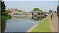
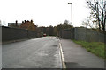
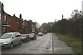
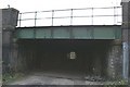
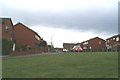
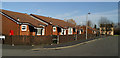
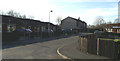
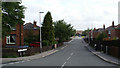
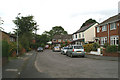
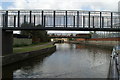
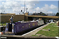
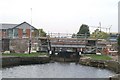
103 photos from this area
Area Information
Key information about the WN3 5AZ including its size, population, and administrative classification.
- Area Type
- Postcode
- Area Size
- 1.3 hectares
- Population
- 2037
- Population Density
- 1526 people/km²
House Prices in WN3 5AZ
6
Properties
-
Average Sold Price
-
Lowest Price
-
Highest Price
Showing 6 properties
| Address | Type | Beds | Baths | Last Sale Price | Last Sale Date | |
|---|---|---|---|---|---|---|
| Nps North West Ltd, Waterside House, Waterside Drive, Wigan, WN3 5AZ | Office | - | - | - | - | |
| British Waterways, Waterside House, Waterside Drive, Wigan, WN3 5AZ | Office | - | - | - | - | |
| Ground Floor, Jubilee House, Waterside Drive, Wigan, WN3 5AZ | Office | - | - | - | - | |
| Walmsleys Commercial Insurance, First Floor, Waterside House, Waterside Drive, Wigan, WN3 5AZ | retail_financial | - | - | - | - | |
| Car Parking Spaces (19) Opp The Wigan Investment Centre & Ct3, Waterside Drive, Wigan, WN3 5AZ | Office | - | - | - | - | |
| First Floor, Jubilee House, Waterside Drive, Wigan, WN3 5AZ | Office | - | - | - | - |
Energy Efficiency in WN3 5AZ
Amenities
Schools
| Rank | School | Type | Entry gender | Ages |
|---|
Explore more schools in this area
Go to Schools tabDemographics
Household Size
One person
most common
Accommodation Type
Houses
most common
Tenure
52
majority
Ethnic Group
White
most common
Religion
N/A
most common
Household Composition
N/A
most common
Age
47
median
Adults (30-64 years)
most common
Household Deprivation
N/A
with no deprivation
NS-SEC
27
in Lower managerial occupations
Explore more demographic insights in this area
Go to Demographics tabPlanning
Planning Constraints
- Flood RiskPremium
- Ramsar Wetland SitesPremium
- Area of Outstanding Natural BeautyPremium
- Protected Nature ReservePremium
- Protected WoodlandPremium