Area Overview for WN2 5XB
Photos of WN2 5XB
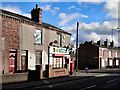
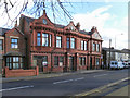
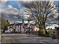
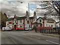
37 photos from this area
Area Information
Key information about the WN2 5XB including its size, population, and administrative classification.
- Area Type
- Postcode
- Area Size
- 7371 m²
- Population
- 1379
- Population Density
- 760 people/km²
House Prices in WN2 5XB
32
Properties
£94,473
Average Sold Price
£25,000
Lowest Price
£222,000
Highest Price
Showing 32 properties
| Address | Type | Beds | Baths | Last Sale Price | Last Sale Date | |
|---|---|---|---|---|---|---|
| 423 Warrington Road, Abram, WN2 5XB | house | 2 | 1 | £120,000 | May 2025 | |
| 371 Warrington Road, Abram, WN2 5XB | Terraced | 4 | 1 | £222,000 | Dec 2024 | |
| 405 Warrington Road, Abram, WN2 5XB | Terraced | 2 | 1 | £93,500 | Mar 2024 | |
| 441 Warrington Road, Abram, WN2 5XB | house | - | - | £110,000 | Dec 2022 | |
| 401 Warrington Road, Abram, WN2 5XB | Retail | 2 | 1 | £92,000 | Jul 2022 | |
| 439 Warrington Road, Abram, WN2 5XB | Terraced | 2 | 1 | £75,500 | Sep 2021 | |
| 373 Warrington Road, Abram, WN2 5XB | Terraced | 2 | 1 | £195,000 | Jul 2021 | |
| 417 Warrington Road, Abram, WN2 5XB | house | 2 | - | £88,000 | Jan 2021 | |
| 445 Warrington Road, Abram, WN2 5XB | Terraced | 2 | 1 | £65,000 | May 2020 | |
| 397 Warrington Road, Abram, WN2 5XB | Semi-detached | 3 | 2 | £107,000 | Mar 2020 |
Page 1 of 4
Energy Efficiency in WN2 5XB
Amenities
Schools
| Rank | School | Type | Entry gender | Ages |
|---|
Explore more schools in this area
Go to Schools tabDemographics
Household Size
One person
most common
Accommodation Type
Houses
most common
Tenure
59
majority
Ethnic Group
White
most common
Religion
N/A
most common
Household Composition
N/A
most common
Age
47
median
Adults (30-64 years)
most common
Household Deprivation
N/A
with no deprivation
NS-SEC
21
in Lower managerial occupations
Explore more demographic insights in this area
Go to Demographics tabPlanning
Planning Constraints
- Flood RiskPremium
- Ramsar Wetland SitesPremium
- Area of Outstanding Natural BeautyPremium
- Protected Nature ReservePremium
- Protected WoodlandPremium